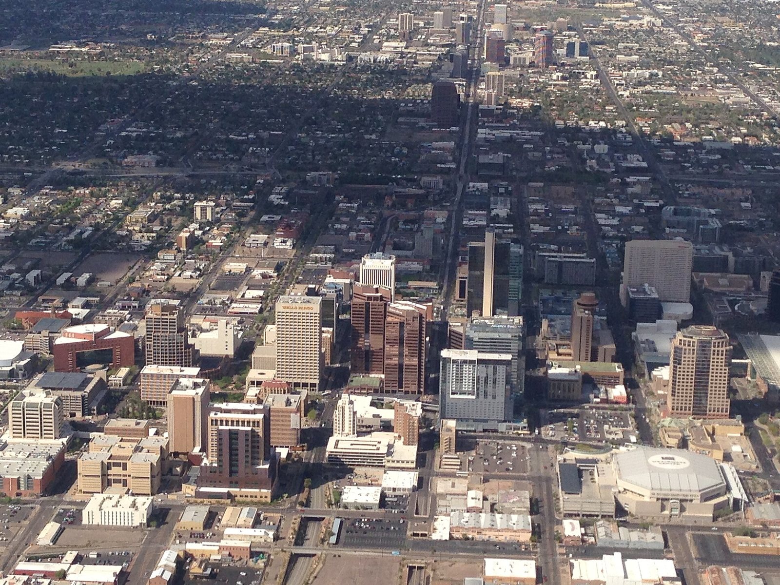
Ask people in the Valley where they live and almost nobody says “Phoenix.” They say Ahwatukee, Gilbert, Sun City or Cave Creek, and each answer puts them in a different corner of a metro area of 5.2 million people. The city of Phoenix alone covers 518 square miles, and more than 20 other cities and towns surround it. Most guides to Phoenix neighborhoods are written for people buying a house. This one is for people staying a week. It covers what each part of the Valley is good for, how long it takes to get there, and which parts you can leave off the list without missing much.
Short answer: For a visitor, Greater Phoenix sorts into five zones: central Phoenix (downtown, Roosevelt Row, Midtown, Uptown and Arcadia) for museums, the arts district and the light rail; Scottsdale and Paradise Valley for resorts; the East Valley (Tempe, Mesa, Chandler, Gilbert) for ASU, Tempe Town Lake and the road to the Superstitions; the West Valley (Glendale, Peoria, Surprise, Goodyear) for the football stadium and four spring training parks; and the foothill towns of Cave Creek, Carefree and Fountain Hills for higher, slightly cooler desert. Downtown Phoenix, Tempe and Old Town Scottsdale are all within 21 minutes of one another off-peak, so most trips work best from that triangle, with everything else as a day trip.
Prices, hours and rules in this guide were last checked on October 1, 2026. Drive times are off-peak estimates measured from Phoenix City Hall unless stated otherwise; add a third or more at rush hour.
Phoenix neighborhoods and Valley cities at a glance
Five zones, what each is for, and what it costs to get around; all drive times were measured with no traffic in October 2026.
| Zone | Main places | Drive from downtown Phoenix (checked Oct 2026) | Getting around and cost | Best time |
|---|---|---|---|---|
| Central Phoenix | Downtown, Roosevelt Row, Grand Avenue, Midtown, Melrose, Uptown, Arcadia, the Camelback corridor | 4-16 min | Light rail, $2 a ride or $4 a day with tap-to-pay | October-April; First Friday evenings; after dark in summer |
| Scottsdale and Paradise Valley | Old Town, the Camelback resorts, Kierland, north Scottsdale | 21-48 min | Free city trolleys in Scottsdale; the Valley’s highest hotel rates | October-May; July for the lowest resort rates |
| East Valley | Tempe, Mesa, Chandler, Gilbert, Queen Creek, Apache Junction | 18-53 min | Light rail to Tempe and Mesa; Tempe Streetcar $1 | Cool-season mornings for the Superstitions; February-March for spring training |
| West Valley | Glendale, Peoria, Surprise, Goodyear, Litchfield Park, Buckeye | 18-47 min | Car only; event parking priced per event | Football season (September-January) and spring training (February-March) |
| North Valley and foothills | Desert Ridge, Anthem, Cave Creek, Carefree, Fountain Hills | 29-49 min | Car only | October-May, plus May and late September, when the extra elevation helps |
How do the Valley of the Sun cities fit together?
The Valley of the Sun is the Salt River Valley, a flat desert basin roughly 1,100 feet above sea level with mountains on every side. Use them as a compass. South Mountain is the long ridge directly south of downtown. Camelback Mountain and Piestewa Peak rise out of the middle of the city. The McDowell Mountains stand behind north Scottsdale to the northeast, the Superstitions mark the eastern edge past Mesa, and the White Tanks close off the west. If you can see Camelback’s hump, you can work out which way you’re facing.
Locals split the metro by direction, and so should you. The East Valley runs out along US 60 and Loop 202 through Tempe, Mesa, Chandler, Gilbert and Queen Creek to Apache Junction. The West Valley follows I-10 and Grand Avenue through Glendale, Peoria, Surprise, Goodyear and Buckeye. The North Valley means far north Phoenix, Anthem, Cave Creek and Carefree, while Scottsdale, Paradise Valley and Fountain Hills fill the northeast. Crossing from one side to the other takes real time: Surprise Stadium to Old Town Scottsdale is 57 minutes off-peak, and Goodyear Ballpark to downtown Mesa is 50 (checked October 2026).
Three tribal nations also hold land inside the metro. The Salt River Pima-Maricopa Indian Community lies between Scottsdale, Mesa and Fountain Hills; Salt River Fields and the Talking Stick resort are on its land even though their addresses say Scottsdale. The Gila River Indian Community runs along the Valley’s southern edge, where Wild Horse Pass is. The Fort McDowell Yavapai Nation borders Fountain Hills and owns the We-Ko-Pa golf courses and casino resort. Each is a sovereign nation with its own government, police and laws.
Here is the Valley city by city, with Census Bureau estimates for July 1, 2025, the off-peak drive from Phoenix City Hall and a one-line verdict.
| City or town | Population (July 2025 est.) | Side of the Valley | Drive from downtown Phoenix (checked Oct 2026) | Worth a visitor’s time for |
|---|---|---|---|---|
| Phoenix | 1,665,481 | Center, 518 sq mi | 4-29 min to its main neighborhoods | Museums, the arts district, light rail, Camelback, Piestewa Peak and South Mountain |
| Mesa | 513,656 | East | 27 min (downtown Mesa) | A half day downtown; the gateway to the Salt River and the Superstitions |
| Gilbert | 287,285 | Southeast | 31 min | Dinner in the Heritage District; a wetlands preserve for birders |
| Chandler | 278,748 | Southeast | 33 min | A meal and a stroll in its small historic downtown |
| Glendale | 260,572 | West | 18 min (downtown), 24 (Westgate) | Cardinals games, concerts, the Fiesta Bowl, spring training |
| Scottsdale | 243,006 | Northeast | 21 min (Old Town) | Resorts, galleries, golf and the McDowell Sonoran Preserve |
| Peoria | 200,881 | Northwest | 32 min | Spring training and Lake Pleasant |
| Tempe | 190,571 | East-central | 18 min | ASU, Tempe Town Lake and the easiest car-free base outside downtown |
| Surprise | 175,304 | Far northwest | 43 min | Spring training only |
| Buckeye | 125,445 | Far west | 47 min | Little for visitors; skip unless someone you know lives there |
| Goodyear | 125,359 | Southwest | 30 min | Spring training; The Wigwam next door in Litchfield Park |
| Queen Creek | 89,770 | Far southeast | 53 min | Farm stops in the cool season |
| Apache Junction | 45,672 | Far east | 47 min | Lost Dutchman State Park and the Superstitions |
| Fountain Hills | 23,625 | Northeast | 43 min | The fountain, paired with Saguaro Lake or We-Ko-Pa |
| Paradise Valley | 12,251 | Northeast | 25 min | Camelback resorts and Cosanti; there’s no downtown |
| Cave Creek | 5,160 | North | 48 min | Western saloons and Spur Cross trails, 1,000 feet above downtown |
| Carefree | 3,600 | North | 49 min | Desert gardens and a giant sundial, 6 min from Cave Creek |
Two numbers explain why older maps feel wrong. Queen Creek has grown 51 percent since the 2020 census and Buckeye 37 percent, while Paradise Valley, Fountain Hills and Carefree have held steady or shrunk slightly. The Valley keeps spreading at its edges, southeast toward Queen Creek and west past Goodyear, and those new subdivisions add drive time, not things to see. The population figures come from the Census Bureau’s annual estimates.
What does a “Phoenix” address actually tell you?
Less than you’d think. The city of Phoenix runs from Laveen and Ahwatukee in the south to Desert Ridge and beyond in the north, so a rental or hotel listed as “Phoenix” can be 3 minutes from the downtown arena or half an hour from it. For planning purposes the city splits itself into 15 urban villages, from Ahwatukee Foothills to North Gateway, and one of them is named Paradise Valley. It is not the Town of Paradise Valley, which is a separate municipality of 12,251 people a few miles to the south.
Mailing addresses follow ZIP codes rather than city limits, which muddies things further: Salt River Fields is listed at 7555 N. Pima Road, Scottsdale, but sits on Salt River Pima-Maricopa land. Before you book, check the map pin and measure the drive to the two or three places you most want to see.
How do you read a Phoenix street address?
Phoenix runs on a grid with its zero point at Central Avenue and Washington Street downtown. Numbered Streets run north-south on the east side of Central and numbered Avenues on the west side, so 7th Street and 7th Avenue are about a mile apart, on opposite sides of the city’s spine. An “E.” or “W.” in an address tells you which side of Central you’re on, and an “N.” or “S.” tells you which side of Washington.
The big east-west roads come at one-mile intervals: north of downtown, McDowell, Thomas, Indian School, Camelback, Bethany Home, Glendale and Northern, in that order. People give directions as intersections of those mile roads (“Camelback and 24th Street”), so learn five of them and you can follow most conversations.
Freeways handle the long hauls: I-10 through downtown and southeast toward Tucson, I-17 north toward Flagstaff, SR 51 past Piestewa Peak, US 60 east through Tempe and Mesa, and Loops 101, 202 and 303 around the edges. At weekday rush hours, add a third or more to every drive time in this guide.
Which central Phoenix neighborhoods are worth your time?
Central Phoenix is where the light rail runs and where a first-time visitor spends most waking hours. The B Line comes down 19th Avenue and Central Avenue through Uptown, Midtown and downtown and carries on south to Baseline Road, and the A Line runs east from downtown past the Sky Harbor stop to Tempe and Mesa. If you haven’t settled what to see yet, our ranked guide to things to do in Phoenix sorts the attractions. This section covers the neighborhoods around them.
Downtown Phoenix
Downtown is the sports, government and convention district, and its core is only a few blocks across. Chase Field, where the Diamondbacks play under a retractable roof, and Mortgage Matchup Center, home of the Suns and Mercury, sit two blocks apart on Jefferson Street; the arena took that name on October 2, 2025, so some map apps still show the old one. The Square PHX, long known as Heritage Square, keeps a block of Victorian-era houses beside the Arizona Science Center, and the original Pizzeria Bianco, a 2026 Michelin Bib Gourmand, is on the square. The convention hotels cluster here too, led by the 1,003-room Sheraton.
West of the core, the Arizona Capitol Museum fills the 1901 capitol building and is always free: weekdays 9 a.m. to 4 p.m., plus Saturdays 10 a.m. to 2 p.m. from September to May (checked October 2026). Downtown works best on foot from October to April. In July the pavement radiates heat long after dark, and Sky Harbor’s normal July low is 84.5°F.
Roosevelt Row and Grand Avenue
Roosevelt Row, just north of the downtown towers, is the arts district: murals on old bungalows and warehouse walls, galleries, small bars and some of the city’s most talked-about kitchens, all within a few blocks of Roosevelt Street. It’s busiest on First Friday, the free monthly art walk Artlink has run since 1994. There are no official hours, because each venue sets its own, and Roosevelt Row’s A.R.T.S. Market sets up the same evening. In September 2026 the City Council approved a one-year pilot allowing art and food vendors to sell on private property in the district between 7th Street and 7th Avenue, so expect more stalls than in past years (checked October 2026). For dinner around here, our guide to the best restaurants in Phoenix covers the reservations worth making.
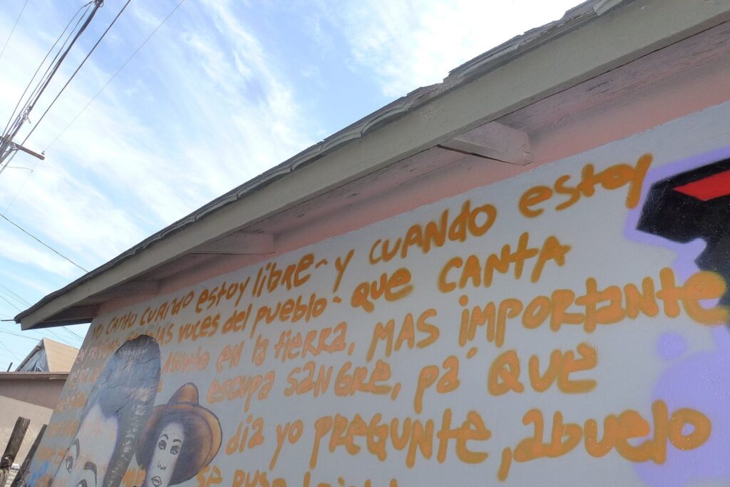
Grand Avenue is the city’s one big diagonal, cutting northwest from the edge of downtown toward Glendale, Peoria and Surprise. Its first stretch, 4 minutes from City Hall, has a smaller arts scene of studios and galleries in old storefronts and workshops. It is less polished than Roosevelt Row and quieter most nights, which is either a drawback or the whole point. Both districts are best after sunset.
Midtown and the Central Avenue museum corridor
Midtown is the run of Central Avenue north of downtown, and it holds the Valley’s two big museums, 3 to 6 minutes from City Hall: the Heard Museum, devoted to American Indian art and cultures, and the Phoenix Art Museum. Timing saves money at both. The Heard is free on First Friday evenings from 4 to 8 p.m., though some add-ons cost extra, and the Phoenix Art Museum is pay what you wish on Wednesdays from 3 to 8 p.m. and free on First Fridays from 5 to 8 (checked October 2026). The Phoenix Public Library’s Culture Pass also gets two people into participating museums free; passes are borrowed in person, first come, first served. With light rail stops all along Central, you can work the whole corridor without moving a car.
Melrose, Uptown and the historic districts
North of Midtown the city turns leafy. West of Central, the historic districts of Willo and Encanto-Palmcroft are blocks of 1920s and 1930s Revival-style houses and bungalows under mature trees, best seen on a cool-season morning walk that ends at Encanto Park. East of Central, Coronado does the same in a more modest key. Seventh Avenue between Indian School and Camelback roads is the Melrose District, a strip of vintage shops, bars and cafes that includes Valentine, a 2026 Michelin Bib Gourmand, and the long-running Fry Bread House. Uptown is the area around Central and Camelback, 11 minutes from downtown, with the shops and restaurants of Uptown Plaza at its center.
None of it is ticketed sightseeing, but it’s the best part of the city for a walk among houses rather than resorts. Go before 9 a.m. from May to September.
Arcadia, the Biltmore and the Camelback corridor
Arcadia spreads across the south side of Camelback Mountain in east Phoenix, about 16 minutes from downtown. It was citrus country, and many lots still have orange and grapefruit trees and the flood irrigation that keeps them green, which makes it one of the few Phoenix neighborhoods with real shade. Camelback’s two summit trails, Echo Canyon and Cholla, start on the mountain’s north and east sides, 22 minutes from downtown and 12 from Old Town Scottsdale. Both are among the trails the city closes from 8 a.m. to 5 p.m. on Extreme Heat Warning days (checked October 2026), so a summer climb means a start before dawn.
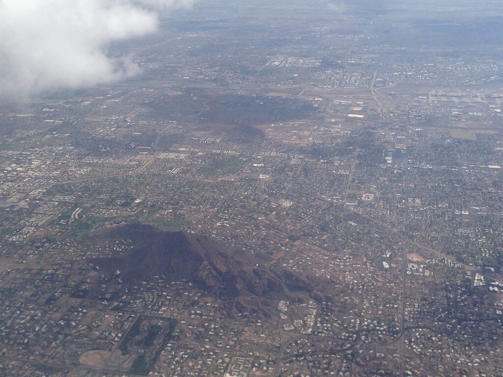
West along Camelback Road, the Camelback corridor holds the city’s second cluster of office towers, Biltmore Fashion Park at 24th Street, and the Arizona Biltmore, which opened in 1929 with Frank Lloyd Wright as a consulting architect. Christopher’s at Wrigley Mansion, on the hill above the resort, made the 2026 Michelin Guide as a Recommended restaurant, and Pizzeria Bianco’s second location is at Town & Country, on 20th Street just south of Camelback. The corridor is 14 minutes from downtown and 13 from Old Town Scottsdale. It’s for shopping, a resort lunch or a special dinner, not for wandering: the sidewalks are long, sunny and lined with parking lots.
North Phoenix: Sunnyslope, the mountain preserve and Desert Ridge
North of the Arizona Canal, Phoenix climbs toward the Phoenix Mountains Preserve. Piestewa Peak’s Summit Trail gains about 1,200 feet in 1.2 miles one way, a route the city rates Extremely Difficult, and it’s another of the trails restricted on Extreme Heat Warning days (checked October 2026). Sunnyslope, an older neighborhood up against the preserve 20 minutes from downtown, has a branch of Little Miss BBQ. Deer Valley, farther northwest, has the ASU-run Deer Valley Petroglyph Preserve.
Far north Phoenix along Loop 101 is newer and more spread out. Desert Ridge, 29 minutes from downtown and about 500 feet higher, has the Desert Ridge Marketplace, with more than 100 brands and a district where adults 21 and up can carry cocktails between bars, plus the JW Marriott resort. Three minutes away, the Musical Instrument Museum opens daily from 9 a.m. to 5 p.m. and charges $20 for adults, $15 for teens and $10 for children 4 to 12 (checked October 2026). It’s the best stop in the Valley for a 110-degree day, and it deserves at least three hours.
South Phoenix, Laveen and Ahwatukee
South Mountain Park and Preserve fills the horizon south of downtown and is the reason to come this way. The park entrance and lots are open 5 a.m. to 7 p.m. and the trails 5 a.m. to 11 p.m., so a sunset drive up to Dobbins Lookout only works when the sun sets before the gate closes, roughly October through March (checked October 2026). The Holbert, Mormon and Hau’pal Loop trails, plus National Trail access from the Pima Canyon trailhead, are restricted on Extreme Heat Warning days. South Phoenix along Baseline Road and Laveen to the southwest, 19 minutes from downtown, are mostly residential, with farm fields giving way to new subdivisions.
Ahwatukee is part of Phoenix too, though it sits on the far side of South Mountain, boxed in by the mountain, I-10 and the Gila River Indian Community. It’s 24 minutes from downtown and 19 from Tempe, and it’s almost entirely homes, schools and shopping centers. Unless you have family there, there’s no reason to base yourself in Ahwatukee.
West Phoenix and Maryvale
West of I-17, Phoenix is mostly residential. Maryvale, a 1950s planned suburb, is where the Brewers train each spring at American Family Fields of Phoenix, 13 minutes from downtown and the closest Cactus League park to City Hall. A March ballgame is the main reason a visitor comes out this way.
Scottsdale and Paradise Valley: the resort side
Scottsdale is a separate city of 243,006 people, spread over 184 square miles and running far north into the desert. Old Town, 21 minutes from downtown Phoenix, is its walkable core of galleries, bars and restaurants, served by free city trolleys. Kierland and Scottsdale Quarter are 32 minutes from downtown Phoenix, Taliesin West is 43 and Pinnacle Peak Park is 48 (checked October 2026). It’s also the Valley’s priciest hotel market: Scottsdale’s market-area hotels averaged $271.17 a night in 2024, according to the city’s lodging report. Scottsdale gets its own set of guides on this site, so this is just the orientation.
Between Phoenix and Scottsdale, the Town of Paradise Valley (12,251 people) wraps around Camelback and Mummy Mountain with large-lot homes and almost no commercial strip at all. What it has instead is resorts, including Sanctuary Camelback Mountain and Mountain Shadows, and Cosanti, Paolo Soleri’s studio, where the bronze and ceramic windbells are still made (open Monday to Saturday 9 a.m. to 5 p.m. and Sunday 11 to 5; checked October 2026). It’s 7 minutes from Old Town Scottsdale and 25 from downtown Phoenix.
The East Valley: Tempe, Mesa, Chandler and Gilbert
The East Valley earns its place on most itineraries: it’s close to Scottsdale and Sky Harbor, the light rail reaches Mesa, and it’s the way out to the river, lakes and mountains.
Tempe
Tempe packs 190,571 people into 40 square miles, the smallest footprint of the Valley’s ten biggest cities, and most of what a visitor wants sits near Mill Avenue. Arizona State University’s main campus runs along one side. Tempe Town Lake, about two miles long on the usually dry bed of the Salt River, runs along the other, with Tempe Beach Park and boat rentals from a private vendor at its edge. The Tempe Streetcar loops 3.1 miles past 14 stops between the lake, downtown Tempe and ASU for $1 a ride, and the A Line light rail connects Tempe with Sky Harbor and downtown Phoenix (checked October 2026).
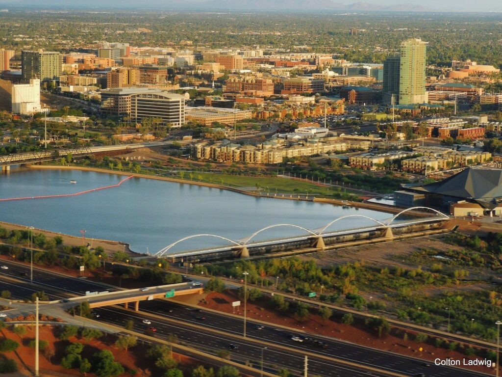
ASU football’s Mountain America Stadium sits on the north edge of campus, Tempe Diablo Stadium hosts the Angels each spring, and Arizona Mills, 10 minutes from Mill Avenue, holds LEGOLAND Discovery Center and SEA LIFE. Tempe is 11 minutes from Old Town Scottsdale, 18 from downtown Phoenix and 11 to 14 from Sky Harbor’s Terminal 4 (checked October 2026), which makes it the best base outside downtown if you’d rather not drive. The caution: Mill Avenue is a college bar street, loud late on weekend and game nights.
Mesa
Mesa is Arizona’s third-largest city, with 513,656 people, and it feels like two places. Downtown Mesa, 27 minutes from Phoenix City Hall and on the A Line, is a walkable Main Street with the Mesa Arts Center, the Arizona Museum of Natural History (dinosaurs, gems and meteorites) and the i.d.e.a. Museum for children 12 and under. Sloan Park, the Cubs’ spring home, and Hohokam Stadium, where the Athletics train, are 8 to 9 minutes apart. The rest of the city is miles of suburbs.
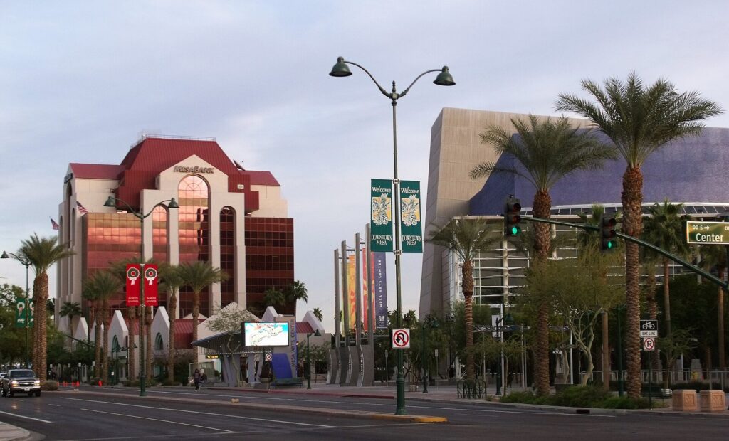
Mesa’s real draw lies past those suburbs. From downtown Mesa, the Salt River’s summer tubing launch is 34 minutes away and Saguaro Lake’s marina 41 (checked October 2026); Usery Mountain Regional Park sits on the city’s northeast edge, wild horses graze along the river below the dams, and the Superstitions rise beyond Apache Junction. Phoenix-Mesa Gateway Airport, the Valley’s second passenger airport, is 28 minutes from downtown Mesa. Give downtown a half day and spend the rest outdoors.
Chandler
Chandler (278,748 people) grew up on farming and, later, on the chip plants along its freeways, and its compact historic downtown around A.J. Chandler Park is the pleasant surprise of the southeast Valley. It’s a square of restaurants, bars and shaded arcades 33 minutes from downtown Phoenix, 16 from downtown Mesa and 12 from Gilbert’s Heritage District. The Ostrich Festival, the city’s big spring event, ran over two March weekends in 2026, and check the festival’s site for its 2027 dates. Wild Horse Pass, on Gila River Indian Community land just west of the city, is 26 minutes from downtown Phoenix (checked October 2026). Come to Chandler for dinner and an evening stroll, not a full day.
Gilbert
Gilbert has 287,285 residents and is still, legally, a town. Its Heritage District, around the old water tower on Gilbert Road 31 minutes from downtown Phoenix, is a few blocks of restaurants, bars and patios. The town’s best free attraction is the Riparian Preserve at Water Ranch: 110 acres with seven ponds, filled in rotation with reclaimed water, more than 4.5 miles of trails and a floating boardwalk that draws birders all year. The town lists the trails as open dawn to dusk, and the Gilbert Rotary Centennial Observatory inside the preserve opens for public viewing Friday and Saturday evenings from sunset to 9:30 p.m., weather permitting (checked October 2026). Dinner in the Heritage District plus a sunset loop at the preserve makes a good East Valley evening.
Queen Creek and Apache Junction
Queen Creek, at the far southeast edge 53 minutes from downtown Phoenix and 27 from Gilbert, is the fastest-growing place in this guide: 89,770 people, up 51 percent since 2020. What’s left of its farm country is the draw. Queen Creek Olive Mill is a working olive farm and mill on Meridian Road, and Schnepf Farms runs a pumpkin festival on fall weekends; check the farm’s own calendar, because listings for the 2026 dates disagreed in early October.
Apache Junction, 47 minutes from downtown Phoenix, is base camp for the Superstition Mountains. Lost Dutchman State Park sits at their foot and charges $10 per vehicle with one person or $20 with two to four (checked October 2026). Goldfield Ghost Town, a rebuilt mining town with a short railroad and a mine tour ($12 each for adults), runs its shops and tours from 10 a.m. to 5 p.m. daily, and the Arizona Renaissance Festival takes over a site in neighboring Gold Canyon on weekends from February 6 to April 4, 2027. The Apache Trail beyond Tortilla Flat is closed; see the skip list below.
The West Valley: Glendale, Peoria, Surprise and Goodyear
The West Valley is where the metro holds its biggest events, and for most visitors that’s the only reason to cross I-17. If you have tickets, it’s easy. If you don’t, almost everything else a first-timer wants is on the other side of town.
Glendale
Glendale (260,572 people) is really two places for a visitor. Its old downtown, 18 minutes from Phoenix City Hall, centers on Murphy Park and Catlin Court, a few blocks of early-1900s bungalows turned into shops and cafes. It’s at its busiest for Glendale Glitters, the holiday light display: check the city for 2026 dates; in 2024 the lights went up on November 29 and stayed through January 1.
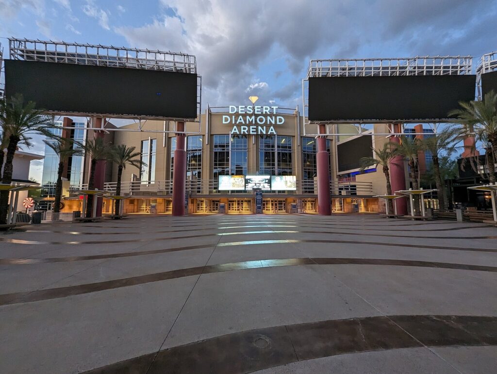
Five miles west, Westgate is the event district, 24 minutes from downtown Phoenix. State Farm Stadium, home of the Arizona Cardinals, has a retractable roof and a natural-grass field that rolls outside to soak up the sun, and it hosts the Vrbo Fiesta Bowl, a College Football Playoff quarterfinal on December 30, 2026 (checked October 2026). Desert Diamond Arena next door holds concerts and Arizona Rattlers indoor football, Tanger Outlets sits alongside, and Camelback Ranch-Glendale, the Dodgers’ and White Sox’s 140-acre spring home, is a few minutes south. Event traffic can double the drive. Without tickets, skip Glendale.
Peoria
Peoria (200,881 people) stretches across 177 square miles, from its old town on Grand Avenue north into the desert toward Lake Pleasant. The Peoria Sports Complex, spring home of the Mariners and Padres, anchors the P83 entertainment district of restaurants and bars, 32 minutes from downtown Phoenix and 14 from Westgate. Lake Pleasant Regional Park, the big reservoir north of the West Valley, is 54 to 61 minutes from downtown depending on which entrance you use, and Maricopa County charges $10 per vehicle to get in (checked October 2026). From central Phoenix, Saguaro Lake is about as far and has better desert scenery.
Surprise, Goodyear, Litchfield Park, Avondale and Buckeye
The far West Valley is growing fastest and offers visitors the least. Surprise (175,304, up 22 percent since 2020) is where the Rangers and Royals train at Surprise Stadium, 43 minutes from downtown Phoenix. Goodyear (125,359, up 30 percent) has Goodyear Ballpark, spring home of the Reds and Guardians, 30 minutes out. Tiny Litchfield Park, next door, has The Wigwam resort and Wildlife World Zoo, which opens every day of the year and keeps more than 600 species; from October through May the zoo runs 9 a.m. to 6 p.m. Avondale is home to Phoenix Raceway, 32 minutes from downtown, whose fall NASCAR weekend runs October 16 to 18, 2026 (checked October 2026).
Buckeye is the outlier: 125,445 people, up 37 percent since 2020, spread over 396 square miles on the western edge, 47 minutes from downtown Phoenix and 62 from Old Town Scottsdale. White Tank Mountain Regional Park on the western rim, 61 minutes from downtown, is the best reason to drive this far west. Otherwise, treat the far West Valley as a single-purpose trip.
North Valley and the foothill towns: Cave Creek, Carefree and Fountain Hills
The towns on the Valley’s northern rim sit noticeably higher than the city, and in the desert, height buys relief. Here is how the elevations compare, using the U.S. Geological Survey’s elevation service.
| Place | Elevation (feet) | Drive from downtown Phoenix (checked Oct 2026) | What’s there |
|---|---|---|---|
| Downtown Phoenix (City Hall) | 1,087 | – | Museums, arenas, light rail |
| Desert Ridge | 1,602 | 29 min | Shopping, the Musical Instrument Museum, resorts |
| Fountain Hills | 1,678 | 43 min | The fountain, Fort McDowell, the road to Saguaro Lake |
| Apache Junction | 1,718 | 47 min | The Superstitions and Lost Dutchman State Park |
| Anthem | 1,845 | 41 min | A master-planned suburb on I-17 |
| Cave Creek | 2,132 | 48 min | Western-flavored town, Spur Cross trails |
| Carefree | 2,393 | 49 min | Desert gardens and a giant sundial |
The standard rule of thumb is that air cools about 3.5°F for every 1,000 feet you climb, so Carefree’s extra 1,300 feet works out to roughly 4 or 5 degrees. That doesn’t make July pleasant anywhere in the Valley, but in May, late September and October it can be the difference between a patio lunch and an indoor one. Anthem, 41 minutes up I-17, has little for visitors, but it’s where the city ends on the drive north to Sedona, 135 minutes from downtown Phoenix to Uptown Sedona.
Cave Creek and Carefree
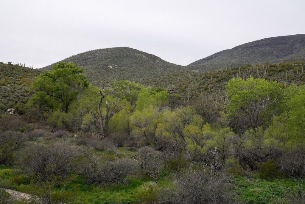
Cave Creek (5,160 people) leans into its Old West roots, with saloons, steakhouses and horse trailers along Cave Creek Road, 48 minutes from downtown. The small Cave Creek Museum keeps a cool-season schedule, October through May. North of town, the Spur Cross Ranch Conservation Area follows the creek through cottonwoods and saguaros, and Maricopa County lists entry at $3 per person, with children 15 and under free (checked October 2026). Carefree (3,600 people) is 6 minutes away and quieter, with the free Carefree Desert Gardens and the Carefree Sundial, a 1959 sundial 62 feet long. Pair them with a morning hike at Spur Cross and an early lunch.
Fountain Hills
Fountain Hills (23,625 people), 43 minutes from downtown Phoenix and 32 from Old Town Scottsdale, was built around the fountain in Fountain Park, which runs for 15 minutes at the top of every hour from 9 a.m. to 9 p.m. and stays off when it’s windy (checked October 2026). It borders the Fort McDowell Yavapai Nation’s We-Ko-Pa golf courses and casino resort and sits on the way to Saguaro Lake, which is the best way to use it: as a lunch stop on a lake or golf day.
How do you get between Phoenix areas?
Central Phoenix, Tempe and parts of Mesa work without a car. Almost everything else in this guide doesn’t. Here is what each option covers (checked October 2026).
| Option | Where it goes | Cost (checked Oct 2026) | Where it doesn’t go |
|---|---|---|---|
| Valley Metro light rail | A Line: downtown, the 44th Street Sky Harbor stop, Tempe and Mesa to Gilbert Road. B Line: north Phoenix down 19th Avenue and Central Avenue to Baseline Road | $2 a ride; tap-to-pay caps at $4 a day and $20 a week | Scottsdale, Westgate, the foothill towns |
| PHX Sky Train | Terminals 3 and 4, the Rental Car Center, East Economy parking and the 44th Street light rail stop | Free, 24 hours | Anywhere outside the airport |
| Tempe Streetcar | 3.1 miles and 14 stops: Tempe Town Lake, downtown Tempe, ASU | $1 a ride | Anywhere beyond Tempe |
| Scottsdale trolleys | Old Town and nearby Scottsdale neighborhoods | Free | Phoenix and Tempe |
| Waymo driverless cars | Downtown Phoenix, Scottsdale, parts of Tempe, Mesa and Chandler, and Sky Harbor’s curbs | Priced per trip in the Waymo app | The West Valley and the foothills |
| Rental car or rideshare | Everywhere | Varies; event parking extra | – |
The light rail has run as two lines since June 2025. Valley Metro lists the last full trips starting between 10:50 p.m. and 12:10 a.m., so a late concert can leave you short of your stop, and tap-to-pay fares cap at $4 a day (checked October 2026; see Valley Metro’s how-to-ride page). You can no longer book a Waymo through Uber in Phoenix; that partnership ended in June 2026, so use the Waymo app.
With a car, stay inside the triangle of downtown Phoenix, Tempe and Old Town Scottsdale, where no leg tops 21 minutes off-peak, and plan one destination a day outside it. Buckeye to Old Town Scottsdale is 62 minutes with no traffic and 80 or more at rush hour.
Which side of the Valley fits your trip?
Match the side of the Valley to the reason you’re here. Which hotel to book on that side is a separate question, with its own math on resort fees and summer rates, and our where-to-stay guide deals with it.
| Your trip is mostly about | Spend your days in | Drive from downtown Phoenix (checked Oct 2026) | Worth knowing |
|---|---|---|---|
| Museums, food and nightlife | Downtown, Roosevelt Row, Midtown, Tempe | 0-18 min | The light rail covers all of it |
| Resorts, spas and golf | Scottsdale, Paradise Valley, the Camelback corridor, Desert Ridge | 14-32 min | Resort days need little driving; everything else does |
| Hiking | Camelback, Piestewa Peak, South Mountain, north Scottsdale’s McDowell Sonoran Preserve | 17-40 min | Trailhead lots fill early; summer means dawn starts only |
| Spring training | East: Tempe, Mesa, Scottsdale. West: Glendale, Peoria, Surprise, Goodyear | 13-43 min | Most east-side parks are 8-18 min apart; west-side parks 16-28 |
| Cardinals games, the Fiesta Bowl, big concerts | Westgate, Glendale | 24 min | Event traffic can double the drive |
| Desert scenery, lakes and the river | Mesa, Fountain Hills, Apache Junction | 27-55 min | Many Salt River sites need a Tonto Pass |
| Cooler, quieter desert | Cave Creek, Carefree | 48-49 min | About 1,000-1,300 feet higher than downtown |
Still building the list? Our guide to what to do in Phoenix ranks the attractions behind these zones. Read it with this map open and the days group themselves: Midtown museums with Roosevelt Row, Papago Park with Tempe, Taliesin West with Old Town Scottsdale, the river with Mesa.
How does summer heat change the map?
From June through September, Phoenix becomes a different city, and its neighborhoods sort differently too. Sky Harbor’s normal high is 106.5°F in July and its normal low is 84.5°F, and the airport averages 111 days a year at 100°F or more (1991-2020 normals). The paved, built-up core holds heat after dark, and the higher foothill towns cool off a little faster, though in July nowhere in the Valley is cool.
The mountains change too. On days the National Weather Service issues an Extreme Heat Warning, the City of Phoenix restricts its busiest summit trails from 8 a.m. to 5 p.m.: Camelback’s Echo Canyon and Cholla, Piestewa Peak’s Summit Trail and its connectors, and South Mountain’s Holbert, Mormon and Hau’pal Loop trails plus National Trail access from Pima Canyon. In 2024 that happened on 45 days between May and October (checked October 2026; see the city’s trail heat-safety page). Monsoon season, June 15 through September 30, adds dust storms and sudden flash floods. Washes that cross roads in the foothills can run fast after a storm, so never drive into moving water.
Plan a summer day by neighborhood: outdoors at first light in the preserves or along Tempe Town Lake, indoors by mid-morning at the Midtown museums or the Musical Instrument Museum, and back out after sunset in Roosevelt Row, Mill Avenue or Old Town Scottsdale. The upside is price: July is when the Scottsdale, Paradise Valley and Camelback corridor resorts are cheapest.
What to skip in the Valley
The Valley is big enough that the wrong drive can cost you half a day. These are the trips and stops to drop, as of October 2026.
- Mystery Castle. The 1930s hand-built house below South Mountain still turns up on attraction lists, but its operators have suspended tours and closed it to visitors during preservation work (checked September 2026). Spend that hour at Dobbins Lookout instead.
- Metrocenter and Paradise Valley Mall. Both malls are gone. Paradise Valley Mall closed in 2021 and was demolished for a mixed-use project, and Metrocenter has closed for redevelopment, yet older maps and guides still list them. Go to Desert Ridge Marketplace, Biltmore Fashion Park or Scottsdale Fashion Square.
- Fountain Hills just for the fountain. It’s 43 minutes each way from downtown Phoenix for a 15-minute show at the top of each hour, and it doesn’t run when it’s windy. Pair it with Saguaro Lake or We-Ko-Pa, or skip it.
- The Apache Trail loop. SR 88 is closed between Tortilla Flat and Apache Lake, so the classic circuit isn’t possible. Driving around to Apache Lake Marina instead takes about 174 minutes each way from downtown (checked October 2026). Make it an out-and-back to Tortilla Flat, or spend the day at Lost Dutchman State Park.
- A far West Valley base for a short trip. Surprise Stadium to Old Town Scottsdale is 57 minutes off-peak, and Buckeye to Old Town is 62. Unless a ballgame, a race or family is the reason for the trip, sleep in the central triangle.
- A rental car for a downtown-and-Tempe trip. The light rail, the free Sky Train and Waymo cover that ground, and parking at Mortgage Matchup Center is priced by event. Rent a car only for the days you go to the foothills or the Superstitions.
- Booking Waymo through Uber. That no longer works in Phoenix. Download the Waymo app before you land.
Frequently Asked Questions
What is the best area of Phoenix for tourists?
For most first trips, the triangle of downtown Phoenix, Tempe and Old Town Scottsdale. Downtown and Midtown have the museums, arenas and light rail; Tempe has ASU, Tempe Town Lake and an easy streetcar; Old Town Scottsdale has galleries and nightlife. No leg of that triangle takes longer than 21 minutes off-peak (checked October 2026), so you can sleep in one and spend evenings in the others.
What cities make up the Valley of the Sun?
The biggest are Phoenix, Mesa, Gilbert, Chandler, Glendale, Scottsdale, Peoria, Tempe and Surprise, followed by Buckeye, Goodyear, Avondale, Queen Creek, Apache Junction, Fountain Hills, Paradise Valley, Cave Creek and Carefree. The Census Bureau’s metro area, which also takes in Pinal County to the south, had 5,228,938 people on July 1, 2025. Tribal nations, including the Salt River Pima-Maricopa Indian Community, hold land inside it too.
Is Scottsdale part of Phoenix?
No. Scottsdale is a separate city of 243,006 people, with its own government, police and hotel taxes. Old Town Scottsdale is 21 minutes from downtown Phoenix off-peak. The confusion comes from mailing addresses, which follow ZIP codes rather than city limits, so some places labeled Scottsdale actually sit in Phoenix or on Salt River Pima-Maricopa Indian Community land, including Salt River Fields.
How far is Mesa from Phoenix?
Downtown Mesa is 27 minutes and about 19 miles from Phoenix City Hall with no traffic, and it’s on the A Line light rail, which runs along Main Street to Gilbert Road. At weekday rush hours, allow 35 to 40 minutes by car. East Mesa near Ellsworth Road, on the way to the Superstitions and the Salt River, is about 40 minutes from downtown Phoenix off-peak.
What part of Phoenix is walkable?
Downtown Phoenix, Roosevelt Row and the Central Avenue museum corridor are walkable and linked by light rail, and so are Tempe’s Mill Avenue and Old Town Scottsdale. Elsewhere, distances and parking lots make walking impractical, and from June to September even the walkable areas are for early mornings and evenings only.
Is the East Valley or the West Valley better for visitors?
For most visitors, the East Valley. Tempe and Mesa are on the light rail and closer to Scottsdale and Sky Harbor, and they lead to the Salt River, Saguaro Lake and the Superstitions. The West Valley is the better choice only when your plans are there: a Cardinals game or concert at Westgate, or spring training in Glendale, Peoria, Surprise or Goodyear.
Which part of the Phoenix area is coolest in summer?
The higher foothill towns. Carefree sits at about 2,393 feet and Cave Creek at 2,132, against 1,087 at Phoenix City Hall, which usually means a few degrees of relief. It isn’t cool, though: on a July afternoon the whole Valley is hot. For real relief you need the high country, such as Prescott or Flagstaff, two hours or more north by car.
Related Phoenix Guides
- Things to Do in Phoenix: the ranked list of attractions these neighborhoods are built around, with prices and timing.
- Best Restaurants in Phoenix: where to book in Roosevelt Row, Melrose, Arcadia and beyond.
Sources and verification
This guide is built from research, not hosted visits. Populations, drive times, prices, hours and rules were checked on October 1, 2026 (a few in late September) against the agencies and operators listed below. Drive times are free-flow estimates from OSRM routing on OpenStreetMap data, and elevations come from the USGS Elevation Point Query Service.
- U.S. Census Bureau: Vintage 2025 city and town population estimates, metro area estimates and 2025 Gazetteer land areas
- City of Phoenix: Village Planning Committees, trail heat safety, South Mountain Park and Preserve, Piestewa Peak trails; Phoenix Public Library: Culture Pass
- Valley Metro: how to ride, Tempe Streetcar, 2026 fare policy
- Phoenix Sky Harbor: PHX Sky Train; Waymo: Phoenix service and FAQ
- City of Tempe: Tempe Town Lake; Town of Gilbert: Riparian Preserve at Water Ranch; Town of Fountain Hills: Fountain Park; City of Scottsdale: lodging statistics and trolley guide
- Arizona State Parks: Lost Dutchman State Park; Maricopa County Parks: Lake Pleasant fees and Spur Cross Ranch
- Museums and attractions: Heard Museum, Phoenix Art Museum, Musical Instrument Museum, Arizona Capitol Museum, Cosanti, Wildlife World Zoo, Goldfield Ghost Town, Mystery Castle
- Venues and events: State Farm Stadium, Mortgage Matchup Center, Arizona Rattlers, Cactus League, Vrbo Fiesta Bowl, Phoenix Raceway, Arizona Renaissance Festival, Artlink First Fridays, Roosevelt Row, MICHELIN Guide American Southwest
- Weather: NOAA 1991-2020 normals for Sky Harbor, NWS Phoenix extreme temperatures
Photo Credits
- Roosevelt Row mural, 2013: photo by Chris English, Wikimedia Commons (CC BY-SA 3.0)
- Camelback Mountain and Paradise Valley from the air: photo by CyberXRef, Wikimedia Commons (CC BY-SA 3.0)
- Tempe Town Lake from the air: photo by FSXIV, Wikimedia Commons (CC BY-SA 3.0)
- Downtown Mesa, Main and Center streets: photo by Ixnayonthetimmay, Wikimedia Commons (CC BY 3.0)
- Desert Diamond Arena, Glendale: photo by Mliu92, Wikimedia Commons (CC BY-SA 4.0)
- Cottonwoods along Cave Creek: photo by This Photo was taken by Timothy A. Gonsalves. Feel free to use my photos, but please mention me as the author. I would much appreciate if you send me an email [email protected] or write on my talk page, for my information. Please contact me before commercial use. Please do not upload an edited image here without consulting me. I would like to make corrections only at my own source to ensure that the changes improve the image and are preserved.Otherwise you may upload an edited image with a new name. Please use one of the templates derivative or extract., Wikimedia Commons (CC BY-SA 4.0)
- Downtown Phoenix and the Central Avenue corridor from the air (featured image): photo by CyberXRef, Wikimedia Commons (CC BY-SA 3.0)