Downtown Phoenix to Uptown Sedona is 116 miles, and with no traffic it takes 135 minutes. Nearly all of that is easy interstate. The part that decides your day is the last stretch, up State Route 179 through the Village of Oak Creek, where the trailhead lots near Bell Rock and Cathedral Rock can be full before 8 a.m. on a spring weekend and the roundabouts back up behind them. The drive from Phoenix to Sedona is simple. Arriving at the right time, with the right pass, and knowing where you’ll park is the hard part, and that is what this guide is about.
Short answer: Leave Phoenix by 6 a.m., take I-17 north to SR 179, and pick one hike, one or two viewpoints and one good meal. Buy a $5 Red Rock Pass (2026 price) if you’ll park at a national forest trailhead, or use the free trailhead shuttle on the days it runs. One day is enough to see the red rocks and do one good hike. It isn’t enough for Oak Creek Canyon, Slide Rock, a jeep tour and Jerome as well; for that, stay a night.
Prices, passes, hours and shuttle details in this guide were last checked on September 24, 2026. Drive times are off-peak estimates; add time for weekend traffic on I-17 and on SR 179 into Sedona.
Phoenix to Sedona at a glance
| What you need to know | Details (checked Sept 2026) |
|---|---|
| Distance and drive | 116 miles; about 135 minutes each way from downtown Phoenix via I-17 and SR 179 |
| From the airport and suburbs | Sky Harbor 142 min; Old Town Scottsdale 147 min; downtown Mesa 157 min |
| Elevation and weather | 4,336 ft; July normal high 96.9°F vs 106.5°F in Phoenix; January nights near freezing |
| Trailhead parking | Red Rock Pass, $5 a day, at most national forest trailheads; interagency passes accepted |
| Free shuttle | City trailhead shuttle, Thursday to Sunday year-round, daily in busy periods |
| Slide Rock State Park | Vehicle entry only; $30 per vehicle May to Aug. 21, 2026, $20 after |
| Best time to go | March to May and September to November, midweek, arriving before 8 a.m. |
| One-day verdict | Enough for one hike, viewpoints and lunch; not enough for everything |
Sedona is the most popular of all the day trips from Phoenix, and at two and a quarter hours each way it is right at the edge of what a day trip should be. It works, but only with an early start and a plan.
How long is the drive from Phoenix to Sedona?
From downtown Phoenix it is 116 miles and about 135 minutes to Uptown Sedona in free-flowing traffic, measured in September 2026. The Village of Oak Creek, at the south end of the red rocks, is 123 minutes away, so you are already among the formations 12 minutes before you reach town. Starting points elsewhere in the Valley add time, because all of them feed onto the same interstate.
| Starting point | Drive to Uptown Sedona (off-peak, Sept 2026) | Miles |
|---|---|---|
| Downtown Phoenix | 135 min | 116 |
| Phoenix Sky Harbor, Terminal 4 | 142 min | 121 |
| Old Town Scottsdale | 147 min | 125 |
| Downtown Mesa | 157 min | 131 |
Traffic is the variable. I-17 north out of the Valley is two lanes each way for long stretches, climbs steeply in places and has few alternatives when something goes wrong. Friday afternoons and weekend mornings northbound, and Sunday afternoons southbound, are when Phoenix heads for the high country, and a crash on the grade can stop everything for an hour. Leave by 6 a.m. and you’ll mostly miss it; leave at 9 on a Saturday and the 135 minutes can stretch well past three hours by the time you’ve crawled into Sedona.
Which route should you take?
There are three sensible ways to do the trip, and the best day uses two of them.
I-17 and SR 179: the fast way in
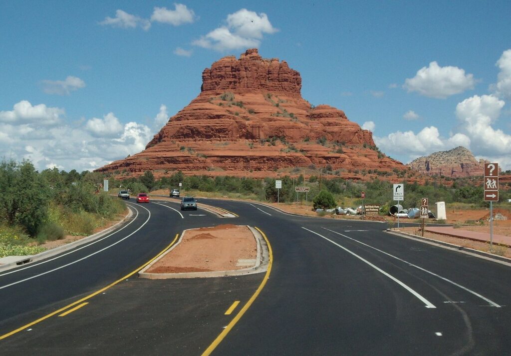
This is the default route, and the one every navigation app picks. Take I-17 north for about an hour and 45 minutes, exit onto State Route 179 at Exit 298, and follow the Red Rock Scenic Byway for the final 15 miles. The byway runs past Bell Rock and Courthouse Butte at the Village of Oak Creek, then past the turnoff for the Chapel of the Holy Cross and the Tlaquepaque shopping village before ending at Uptown Sedona. It is a gorgeous entrance and, on busy days, a slow one, because a string of roundabouts meters the traffic.
Via SR 260, Cottonwood and SR 89A: the long way with Jerome
Leave I-17 at Exit 287, take SR 260 through Camp Verde to Cottonwood, then SR 89A into West Sedona. It is 146 minutes from downtown Phoenix, 11 more than the fast route. You arrive on the commercial side of town rather than through the red rocks, but you pass within easy reach of Jerome, the hillside mining town 45 minutes from Uptown, and Tuzigoot National Monument near Clarkdale. On a two-stop day this is the natural way in or out.
Home through Oak Creek Canyon and Flagstaff: the scenic loop
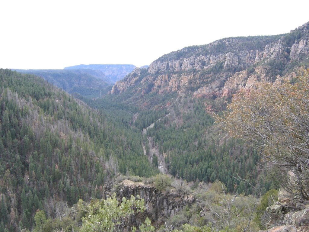
Instead of going back down SR 179, drive north from Uptown on SR 89A through Oak Creek Canyon to Flagstaff, 58 minutes and 29 miles, then take I-17 south to Phoenix, another 155 minutes. The loop adds about an hour and 20 minutes to the direct return, and it is worth it at least once: the road follows the creek under sycamores and pines, then climbs a series of tight switchbacks out of the canyon onto the pine-covered plateau. It makes the most sense in summer, when Flagstaff’s normal July high is 82.0°F. In winter it can be icy near the top, and Flagstaff averages about 90 inches of snow a year, so check conditions before you commit.
Where should you stop on the way to Sedona?
The interstate itself is mostly desert and then rolling grassland, but two stops near it are worth the time, and a third is worth knowing about.
Montezuma Castle National Monument. A five-story Sinagua cliff dwelling set into a limestone cliff above Beaver Creek, a short detour from I-17 about 104 minutes from downtown Phoenix. You see it from a short paved loop, which takes most people under an hour. Entry is $10 per adult, children 15 and under free, and the ticket also covers Tuzigoot National Monument for 7 days (checked September 2026). On the way up it adds about an hour to the day; on the way home, 41 minutes back down the road from Uptown, it is an easy last stop.
Arcosanti. Paolo Soleri’s unfinished experimental town sits just off I-17 at Cordes Junction, 74 minutes from downtown Phoenix. It is a quick, strange and interesting stop for anyone who cares about architecture, best with a guided tour. Most Sedona day-trippers skip it, and on a one-day trip that is probably right.
Sunset Point. The rest area on I-17 north of Black Canyon City has restrooms and a wide view west over the Bradshaw Mountains. It’s the obvious place to stretch your legs about halfway, and it costs nothing but ten minutes.
How do the Red Rock Pass and the Sedona Shuttle work?
Most day-trip frustration in Sedona comes from parking, and two systems deal with it: a pass for national forest trailheads and a free shuttle to the busiest ones.
Do you need a Red Rock Pass?
Most of the land around Sedona is Coconino National Forest, and most of its trailheads and day-use sites require a Red Rock Pass displayed in your car. Hiking is free; parking is what you pay for. The pass costs $5 for a day, $15 for a week and $20 for a year, and you can buy it from fee machines at the trailheads, at the Sedona visitor center or on Recreation.gov (checked September 2026). If you already have an interagency America the Beautiful pass, display it instead; Visit Sedona’s Red Rock Pass guide covers the details and which sites take which pass.
You don’t need a Red Rock Pass to park in Uptown, at Tlaquepaque, at the Chapel of the Holy Cross, or at Slide Rock and Red Rock state parks, which charge their own fees. A few popular sites along Oak Creek are run by concessionaires with separate day-use fees, so read the sign at the entrance before you assume your pass covers it.
How does the Sedona Shuttle work?
The City of Sedona runs a free trailhead shuttle to five of the busiest and smallest trailheads: Cathedral Rock, Little Horse, Soldier Pass, Dry Creek Vista (the start for Devil’s Bridge) and Mescal. You park at a park-and-ride lot, at Posse Grounds Park, on West SR 89A or on North SR 179, and ride out to the trail. According to the city, the trailhead routes run Thursday through Sunday all year and every day in busy periods; in 2026 that meant daily service from February 26 through April 26 for spring break, with buses running from about 7 a.m. to 5:30 p.m. A separate on-demand service, Sedona Shuttle Connect, costs $2 a ride, $1 for seniors (checked September 2026).
For a day-tripper, the shuttle turns a gamble into a plan. The lots at Cathedral Rock and Soldier Pass are small and fill early, and Devil’s Bridge is reached by a rough dirt road that most rental cars shouldn’t attempt. If your day falls on a shuttle day, use it for those trails. If it doesn’t, arrive before 8 a.m. or choose a trailhead with a larger lot.
What about parking in Uptown?
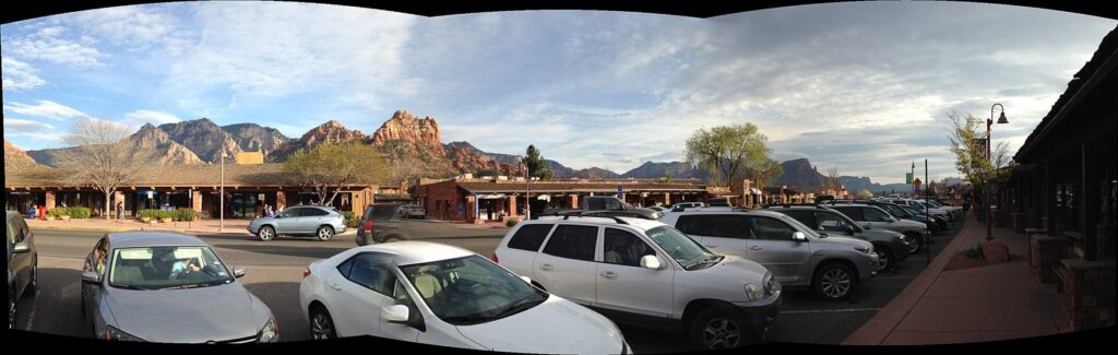
Uptown Sedona, the strip of shops, galleries and restaurants along SR 89A, has metered street parking and paid lots, and the city publishes live availability online. Expect to pay by the hour anywhere in the center, and check the city’s site for current garage rates. Tlaquepaque, on SR 179 just south of Uptown, has its own parking and makes a less stressful lunch stop on busy days.
What can you do in one day in Sedona?
Everything in Sedona’s core is close together, which helps. From Uptown it is 8 minutes to the Airport Mesa overlook, 10 to the Chapel of the Holy Cross, 11 to the Cathedral Rock and Bell Rock trailheads, 13 to Slide Rock State Park, 21 to the West Fork trailhead in Oak Creek Canyon and 21 to Red Rock State Park (off-peak, measured September 2026). The trick is to pick one hike and build the day around it.
A classic first-timer’s day
| Time | Stop | Notes |
|---|---|---|
| 6:00 a.m. | Leave downtown Phoenix | Beat the I-17 traffic and the trailhead crowds |
| 8:15 a.m. | Bell Rock and Courthouse Butte | Village of Oak Creek; easy to moderate trails; Red Rock Pass |
| 10:45 a.m. | Chapel of the Holy Cross | Free; the access road and lot are small |
| 11:30 a.m. | Tlaquepaque or Uptown | Lunch, galleries and shops |
| 1:30 p.m. | Shuttle to Cathedral Rock or Soldier Pass, or Red Rock State Park | Shuttle Thursday to Sunday; the state park any day |
| Late afternoon | Airport Mesa | The classic view over town as the light turns red |
| After sunset | Drive home via SR 179 and I-17 | About 135 minutes to downtown Phoenix |
This day works in any season, with adjustments. In summer, do the hike first and fast, and move the midday stops indoors. In winter, the sun sets around 5:20 p.m., so Airport Mesa comes around 4:30 and you drive home in the dark.
A Monday-to-Wednesday day, without the shuttle
If your day falls outside the shuttle’s Thursday-to-Sunday schedule and outside the busy periods when it runs daily, build the morning around trailheads with room to park. The Bell Rock area along SR 179 has several lots, and Red Rock State Park has its own, with an 8 a.m. opening. Save Cathedral Rock, Soldier Pass and Devil’s Bridge for a shuttle day or for an arrival well before 8 a.m., because their small lots are usually the first to turn cars away. Midweek is also when Uptown’s parking is easiest, so it’s a good day to linger over lunch and walk the galleries rather than race between trailheads.
A summer canyon day
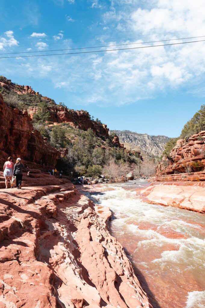
From June to August, go north into Oak Creek Canyon, where the creek and the shade make the heat bearable. Slide Rock State Park, 13 minutes from Uptown, is a natural water slide in the creek bed and one of the most popular summer spots in Arizona. Entry is by vehicle only through the entry station, with no walk-ins, drop-offs or bicycle entries and no reservations, and the park asks people not to line up on the highway before it opens. The fee was $30 per vehicle for one to four adults from May through August 21, 2026, and $20 after that (checked September 2026). In peak season the park opens at 8 a.m. and stops admitting people and closes the swim area at 5 p.m. Arrive at opening on a weekday or expect to wait.
After Slide Rock, the West Fork of Oak Creek, 21 minutes from Uptown, is a shaded canyon hike with creek crossings, and then the road climbs to Flagstaff for dinner at 7,000 feet and the long way home.
A history day with Jerome
Stop at Montezuma Castle on the way up, spend the late morning in Sedona at the Chapel and Tlaquepaque, then drive 45 minutes to Jerome for the afternoon and come home via Cottonwood and SR 260. You trade a hike for two towns and a cliff dwelling, which suits a cooler day or travelers who would rather wander than climb.
What are the best things to see in Sedona on a day trip?
Short of a week, you have to choose. These are the stops that repay a day-tripper’s time, grouped by what they take.
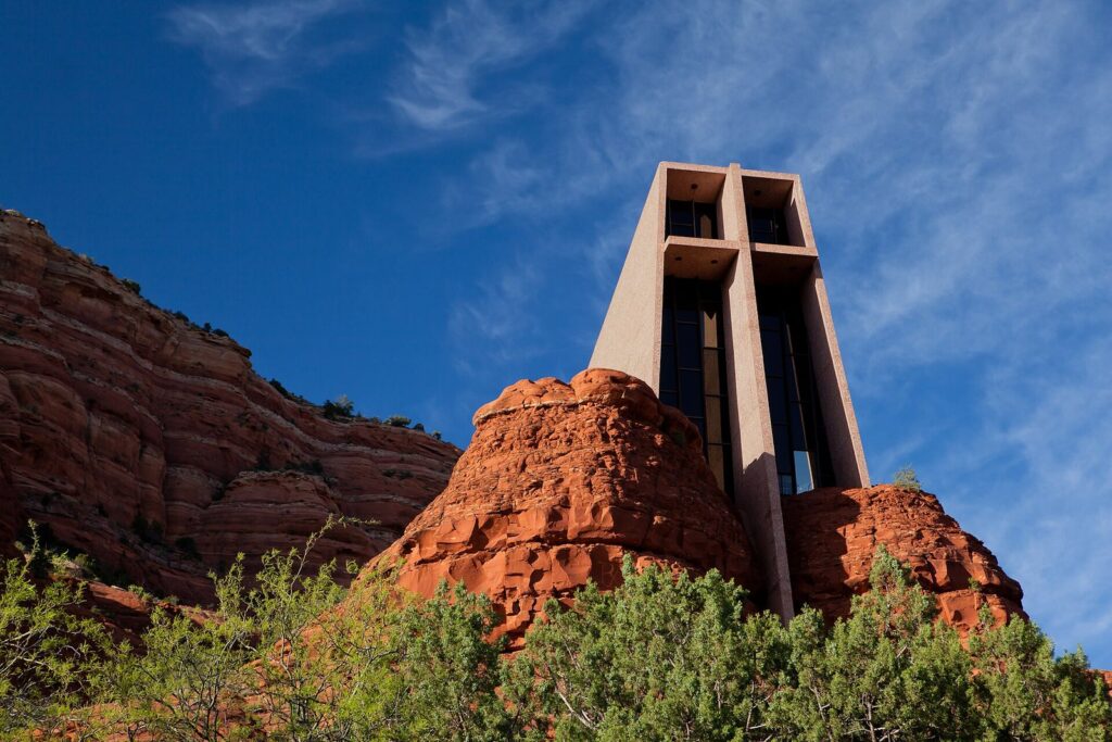
Viewpoints you can drive to. Airport Mesa, 8 minutes from Uptown, looks over the whole town and is the classic late-afternoon view. The Chapel of the Holy Cross, a small modern chapel built into the red rock south of town, is free to visit and has a view down the valley toward Bell Rock. Both have small parking areas, so expect to circle on weekends.
Easy walks. The Bell Rock Pathway and the loop around Courthouse Butte, at the Village of Oak Creek, are wide, mostly gentle trails through the heart of the red rocks. Red Rock State Park, 21 minutes from Uptown, has shaded creekside trails and a visitor center, and is open 8 a.m. to 5 p.m. with last entry at 4:30 (checked September 2026). Both suit families and anyone who wants the scenery without a scramble.
Signature hikes. Cathedral Rock’s trail is short but steep, with a scramble near the top. Devil’s Bridge, reached from the Dry Creek Vista trailhead, crosses Sedona’s largest natural sandstone arch. Soldier Pass passes a collapsed sinkhole and a string of small pools. All three are busy, and all three are on the free shuttle’s routes. Pick one, not three, and start early.
Town. Uptown’s galleries, shops and restaurants line SR 89A, with red rock views at the end of every side street. Tlaquepaque, a Mexican-village-style arts and shopping center on SR 179, is the prettier place to wander and eat. Sedona is also a designated dark-sky community, so if you stay after dark on a clear night, look up before you leave.
Tours. Jeep tours run from Uptown on rough roads you shouldn’t take a rental car on, and they are a good way to see the backcountry in a short day. Prices vary by route and season, so compare a couple of operators and book ahead in spring and fall.
When is the light best for photos?
Sedona’s rocks change color through the day, and a day-tripper who plans around the light gets far better pictures than one who arrives at noon. The red sandstone glows brightest in low sun, so the first two hours after sunrise and the last two before sunset are the times to be at a viewpoint. In the late afternoon the sun lights the west-facing cliffs, which is why Airport Mesa, with its view east over town, and the banks of Oak Creek below Cathedral Rock draw crowds before sunset. Midday light flattens everything; use it for lunch, the drive or a shaded canyon.
Weather adds the drama. Monsoon clouds in July and August stack up behind the rocks in the afternoon, and a dusting of snow on the red formations after a winter storm is the picture everyone wants and few get. Both reward flexibility: if you see the right sky forecast, go that day.
What are Sedona’s vortexes?
Sedona has a long-standing reputation as a place of “vortexes”, spots where believers say the earth’s energy is concentrated, and it draws spiritual visitors as well as hikers. The places most often named are Airport Mesa, Bell Rock, Cathedral Rock and Boynton Canyon, which also happen to be among the most scenic spots in the area. You don’t need to believe in vortexes to enjoy the views, and you’ll share the trails with people meditating, drumming or simply sitting quietly. Guided vortex tours and readings are sold in Uptown; treat them like any other tour and compare before you book.
Should you choose Sedona or another day trip?
Sedona is the most famous day trip from Phoenix, but on some days it isn’t the best one. Choose by what you want from the day, using drive times from downtown Phoenix measured in September 2026.
Choose Sedona when the red rocks are the point: the colors, the formations, a hike among them and a sunset over them. Nothing else within a day’s drive looks like it. Accept that on a spring or fall weekend you’ll share it with a lot of other people.
Choose Jerome and the Verde Valley when you want a small town and history without Sedona’s crowds. Jerome is 133 minutes from Phoenix, about the same as Sedona, sits at 5,070 feet and has views across the valley to the red rocks. You can see Sedona’s rocks from a distance and spend the day in a hillside mining town instead.
Choose Prescott when you want the easiest cool-air day. At 119 minutes it is the closest of the high-country towns, and its normal July high is 90.3°F, well below Sedona’s 96.9°F.
Choose Flagstaff in July and August. At 155 minutes it’s the farthest, but its normal July high of 82.0°F makes it the real summer escape, and the drive home through Oak Creek Canyon lets you see Sedona on the way.
Choose Tucson in winter when you want saguaros, a mission and a museum instead of red rock. It’s 122 minutes south, and its desert is at its best from November to March, when Sedona’s nights are near freezing.
Is one day enough for Sedona?
For a first taste, yes. A well-planned day gives you the drive through the red rocks, one real hike, a viewpoint or two, lunch and the late-afternoon light, and that is what most people come for. What one day can’t do is give you more than one of the big experiences. Slide Rock, a jeep tour, Oak Creek Canyon, Jerome and a second hike each take a meaningful slice of the day, and the drive already takes four and a half hours of it.
A night changes the trip. You get sunrise and sunset on the rocks, a starry sky, a second morning for the trail you didn’t reach, and no two-hour drive in the dark after a long day. If you can stay one night, stay; if you can only spare a day, make it a good one and accept that you’re sampling. Either way, frame Sedona as an extension of a Phoenix trip rather than a separate vacation, and you’ll plan it better.
When is the best time to go from Phoenix to Sedona?
Sedona sits at 4,336 feet, 3,250 feet higher than downtown Phoenix, and it is about ten degrees cooler through most of the year. Its normal July high is 96.9°F, against 106.5°F in Phoenix, and its January high is 58.3°F against 67.6°F. The bigger difference is at night: Sedona’s normal January low is 34.0°F, against 46.0°F in Phoenix, so pack layers from November through March.
| Season | Sedona normal highs | What it means for a day trip |
|---|---|---|
| Spring (March-May) | 67.5°F, 74.7°F, 83.7°F | The best weather and the biggest crowds; the shuttle ran daily Feb 26-Apr 26 in 2026 |
| Summer (June-August) | 94.1°F, 96.9°F, 94.2°F | Hot by midday, monsoon storms in July and August; go early or head for Oak Creek |
| Fall (September-November) | 88.8°F, 78.7°F, 66.9°F | Excellent; fall color in Oak Creek Canyon; busy weekends |
| Winter (December-February) | 57.8°F, 58.3°F, 61.3°F | Quietest; the wettest months; occasional snow on the rocks; short days |
Spring: the best weather and the most company
March through May brings highs from the upper 60s to the low 80s and the year’s biggest crowds, with spring break on top. The city’s decision to run the trailhead shuttle every day from February 26 to April 26 in 2026 tells you how busy those weeks are. Come midweek if you can, start early and use the shuttle for the famous trails.
Summer: go early, or go to the creek
Sedona’s normal July high of 96.9°F is ten degrees cooler than Phoenix, but it is still too hot for an exposed red-rock hike at midday. Hike at first light, then move to Oak Creek Canyon, a museum or lunch. The monsoon arrives in July and August, which average 1.62 and 2.04 inches of rain, usually as afternoon thunderstorms; lightning is a real danger on open slickrock and summits, and washes and creek crossings can flood quickly. If thunderheads are building, get off the high ground and stay out of dry creek beds.
Fall: the day-tripper’s season
September is still warm, at 88.8°F, but October’s 78.7°F and November’s 66.9°F are close to ideal for hiking, and the sycamores and maples in Oak Creek Canyon turn color in late October and November. Fall weekends are busy, though rarely as busy as spring break, and the drive home through the canyon is at its best.
Winter: quiet, short and sometimes white
December through February brings highs in the upper 50s and low 60s, nights near freezing and the year’s wettest months, with about two inches of precipitation in January and again in February. Some of it falls as snow, which can close trails briefly and makes the switchbacks above Oak Creek Canyon slippery. The reward is space: winter weekdays are the quietest time to see Sedona, and the low sun keeps the rocks glowing for longer. Plan for the sun to set around 5:20 p.m. in December.
Midweek beats weekends in every season. Sedona gets about 17 inches of precipitation a year, most of it in winter and in the summer monsoon, so a rainy January day is possible in a way it rarely is in Phoenix. The best combination for a day trip is a weekday in late October, early November, March or April, with a 6 a.m. start.
What does a Sedona day trip from Phoenix cost?
| Item (checked Sept 2026) | Cost | Notes |
|---|---|---|
| Red Rock Pass | $5 a day | For national forest trailheads; $15 a week, $20 a year |
| Sedona Shuttle trailhead routes | Free | Park-and-ride lots; Thursday to Sunday and busy periods |
| Sedona Shuttle Connect | $2 a ride ($1 seniors) | On-demand service around town |
| Slide Rock State Park | $20-$30 per vehicle | $30 May to Aug. 21, 2026; $20 after; one to four adults |
| Montezuma Castle | $10 per adult | Children 15 and under free; includes Tuzigoot for 7 days |
| Chapel of the Holy Cross | Free | Small parking area |
| Uptown parking | Hourly | Metered street spaces and paid lots |
| Fuel | About 10 gallons | Roughly 260 miles round trip with local driving, at 25 mpg |
Here is how the 2026 fees add up for two adults. A fall day with a Red Rock Pass and Slide Rock costs $25 in fees: $5 for the pass and $20 for the park. The same day in July costs $35, because Slide Rock’s vehicle fee is $30 through August 21. Add Montezuma Castle on the way up and it’s another $20 for two, with Tuzigoot included. A frugal day for two, with a Red Rock Pass, a hike, a picnic and a free chapel visit, costs little more than gas and $5. Add Slide Rock in summer, a sit-down lunch and a jeep tour and the same day can run into the hundreds. Neither is wrong; just decide which day you’re having before you leave.
What should you plan for the drive home?
The drive back is the part people forget to plan, and it is where tired day trips go wrong. The sun sets in Phoenix at about 5:22 p.m. in mid-December, 6:35 p.m. in mid-March, 7:39 p.m. in mid-June and 6:36 p.m. in mid-September, and Sedona’s sunset is within a few minutes of those times. If you stay for sunset at Airport Mesa, you’ll reach downtown Phoenix roughly two and a quarter hours later, after dark in every season.
That is fine with a little planning. Eat dinner in Sedona or in Camp Verde or Cottonwood before you get on the interstate, so you aren’t hunting for food at 9 p.m. Fill the tank in the Verde Valley. Share the driving if you can, because the climb down from the high country toward Black Canyon City is long and dark, and deer and elk can be on the road north of the Valley at night. On Sunday evenings, expect southbound I-17 to be busy with everyone else coming home from the mountains; leaving Sedona by mid-afternoon on a Sunday, or on Monday instead, spares you most of it.
How do you plan a Sedona day with kids?
Keep it simple and shorter than you think. Two hours and a quarter each way is a long time in a car seat, so plan a stop at Sunset Point on the way up, one main activity, lunch and one viewpoint, and leave the scrambles for another trip.
The best choices for families are the gentle ones. The Bell Rock Pathway and the loop around Courthouse Butte are wide and mostly level. Red Rock State Park has shaded trails along Oak Creek and a visitor center. The Chapel of the Holy Cross takes 20 minutes and impresses almost everyone. In summer, Slide Rock State Park is the day kids remember, with water shoes and an early arrival; the $20-$30 vehicle fee in 2026 covers up to four adults, so it’s reasonable for a family.
Skip the steep, exposed trails with small children. Cathedral Rock’s upper section is a scramble on bare rock, and the famous photo spot on Devil’s Bridge has long drops on both sides. A jeep tour is a good alternative for older kids who want the backcountry without the hike; check age and car-seat rules with the operator when you book.
What else is there in the Verde Valley?
Sedona sits on the northern edge of the Verde Valley, and a day trip can borrow from its neighbors. Camp Verde, off I-17 on the way up, has Montezuma Castle nearby. Cottonwood, on SR 89A west of Sedona, has a walkable old downtown with restaurants and wine-tasting rooms that pour Verde Valley wines. Tuzigoot National Monument, a hilltop pueblo near Clarkdale, is covered by the same $10 ticket as Montezuma Castle for 7 days (checked September 2026). Clarkdale is also the starting point for the Verde Canyon Railroad’s excursion trains, and Jerome, 45 minutes from Uptown Sedona, looks down on all of it from Cleopatra Hill.
You can’t do all of that and Sedona in one day. But on a day when Sedona’s trailheads are full, or the weather is poor for hiking, the Verde Valley is a good plan B that is already on your route home.
What should you bring on a Sedona day trip?
Pack for a different climate from the one you left. Sedona is more than 3,000 feet higher than Phoenix, so a morning that starts in the 40s in winter or the 60s in summer can warm up fast, and you’ll want a layer you can take off. Bring more water than you think a short hike needs, sun protection, and shoes with grip, because the red slickrock is smooth and the sandy trails are loose. Have a way to pay for a Red Rock Pass before you reach the trailhead, and download maps for the day, since cell service can be patchy in Oak Creek Canyon and on the drive home. In summer, add water shoes for Slide Rock and a plan for the afternoon storms.
Can you get from Phoenix to Sedona without a car?
You can, but you give up most of what makes the day work. Private airport shuttles and guided tours run from Phoenix to Sedona, and a tour takes the driving and parking off your hands, at the cost of a fixed schedule. Once in Sedona, the free trailhead shuttle and the $2 on-demand service (2026 fare) cover the core of town and five trailheads. What they don’t cover is the rest: Oak Creek Canyon, Slide Rock, the Verde Valley and Jerome. For a day trip, a car is the practical choice.
What to skip on a Sedona day trip
- Skip arriving after 9 a.m. on a weekend. The popular trailhead lots are full, SR 179 is slow, and you’ll spend your best hours looking for parking.
- Skip trying to do everything. One hike, one or two viewpoints and a meal is a great day. Five stops is a long day in the car.
- Skip driving a rental car to Devil’s Bridge. The dirt road to the closest trailhead is rough. Take the shuttle to Dry Creek Vista or walk in from the paved trailhead.
- Skip Slide Rock on a summer weekend afternoon. Entry is by vehicle only, the line forms before opening, and the park stops admitting cars an hour before closing.
- Skip Schnebly Hill Road in an ordinary car. The views are superb, but it’s a rough dirt road; see it on a jeep tour instead.
- Skip the Oak Creek Canyon switchbacks after dark in winter. Ice near the top and a long drive home make the direct SR 179 route the better choice from November to March.
- Skip assuming Sedona is cool in summer. A 96.9°F July normal is only cool compared with Phoenix. Hike at dawn there, too.
Frequently Asked Questions
How far is Sedona from Phoenix?
Uptown Sedona is 116 miles from downtown Phoenix, about 135 minutes’ drive off-peak via I-17 and State Route 179 (checked September 2026). From Sky Harbor Airport it is about 142 minutes, and from Old Town Scottsdale about 147. Weekend traffic on I-17 and the roundabouts on SR 179 can add a lot, so allow extra time.
Is Sedona worth a day trip from Phoenix?
Yes, if you leave early and keep the plan simple: one hike, one or two viewpoints and a meal. The drive takes about four and a half hours round trip, so one day isn’t enough for Slide Rock, Oak Creek Canyon, a jeep tour and Jerome as well. If you want those, or sunrise and stars on the red rocks, stay a night.
Do you need a Red Rock Pass in Sedona?
You need one to park at most Coconino National Forest trailheads and day-use sites around Sedona. It costs $5 a day, $15 a week or $20 a year (checked September 2026), and an interagency America the Beautiful pass works instead. You don’t need it in Uptown, at the Chapel of the Holy Cross or at the state parks, which charge their own fees.
What is the best route from Phoenix to Sedona?
I-17 north to Exit 298, then SR 179, the Red Rock Scenic Byway, into Sedona: about 135 minutes from downtown Phoenix. The alternative via SR 260, Cottonwood and SR 89A takes about 146 minutes and passes near Jerome. For a scenic return, drive through Oak Creek Canyon to Flagstaff and take I-17 home, which adds about 80 minutes.
What time should you leave Phoenix for Sedona?
By 6 a.m. That puts you at the Village of Oak Creek around 8:15, before the popular trailhead lots fill and before the weekend traffic on I-17 and SR 179 builds. In summer, an early start also gets your hike done before Sedona’s midday heat, which averages 96.9°F in July. On a weekday you can leave a little later.
Is the Sedona Shuttle free?
The trailhead routes are free. They run from park-and-ride lots to Cathedral Rock, Little Horse, Soldier Pass, Dry Creek Vista and Mescal, Thursday through Sunday all year and daily in busy periods such as spring break. The separate on-demand Sedona Shuttle Connect service costs $2 a ride, or $1 for seniors, as of September 2026.
How much cooler is Sedona than Phoenix?
About ten degrees by day. Sedona’s normal July high is 96.9°F against Phoenix’s 106.5°F, and its January high is 58.3°F against 67.6°F. Nights differ more: Sedona’s January low is 34.0°F, Phoenix’s 46.0°F. Sedona sits at 4,336 feet, more than 3,000 feet higher than downtown Phoenix.
Can you see Sedona and the Grand Canyon in one day from Phoenix?
Not sensibly. Phoenix to the Grand Canyon’s South Rim is about 255 minutes each way on its own. Adding Sedona, then Oak Creek Canyon to Flagstaff and on to the rim, means more than nine hours of driving in a single day, with almost no time at either place. Do Sedona as a day trip, and give the Grand Canyon at least one night.
Related Phoenix Guides
- More Day Trips from Phoenix: the Superstitions, Tucson, Jerome, Prescott and Flagstaff, with drive times both ways.
Sources and verification
This guide is built from research, not hosted visits. Passes, fees, hours and shuttle details were checked on September 24, 2026, against the agencies and operators below. Drive times are off-peak estimates from OSRM routing on OpenStreetMap data, measured on September 24, 2026; climate figures are NOAA’s 1991-2020 normals.
- Arizona State Parks: Slide Rock State Park; Red Rock State Park
- National Park Service: Montezuma Castle and Tuzigoot fees
- Coconino National Forest and Visit Sedona: Red Rock Pass program
- City of Sedona: Sedona Shuttle expanded spring schedule; parking in Uptown; Sedona Shuttle trailhead routes
- NOAA: 1991-2020 normals for Sedona, Phoenix and Flagstaff
Photo Credits
- Bell Rock and SR 179: photo by Josep Renalias, Wikimedia Commons (CC BY-SA 3.0)
- Oak Creek Canyon: photo by Postdlf, Wikimedia Commons (CC BY-SA 3.0)
- Uptown Sedona: photo by Jack CameraMan, Wikimedia Commons (CC BY 3.0)
- Slide Rock State Park: photo by mbaylor, Wikimedia Commons (CC BY 2.0)
- Chapel of the Holy Cross: photo by Matthew P. Del Buono, Wikimedia Commons (CC BY-SA 3.0)
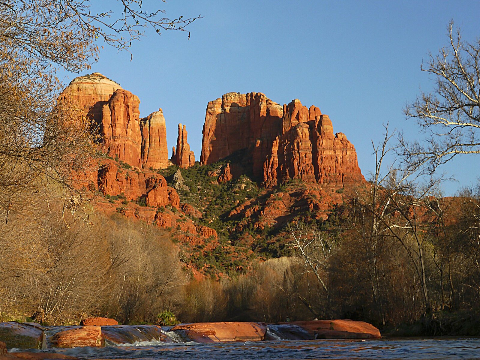
- Cathedral Rock from Oak Creek (featured image): photo by Terrydarc, Wikimedia Commons (CC BY-SA 3.0)