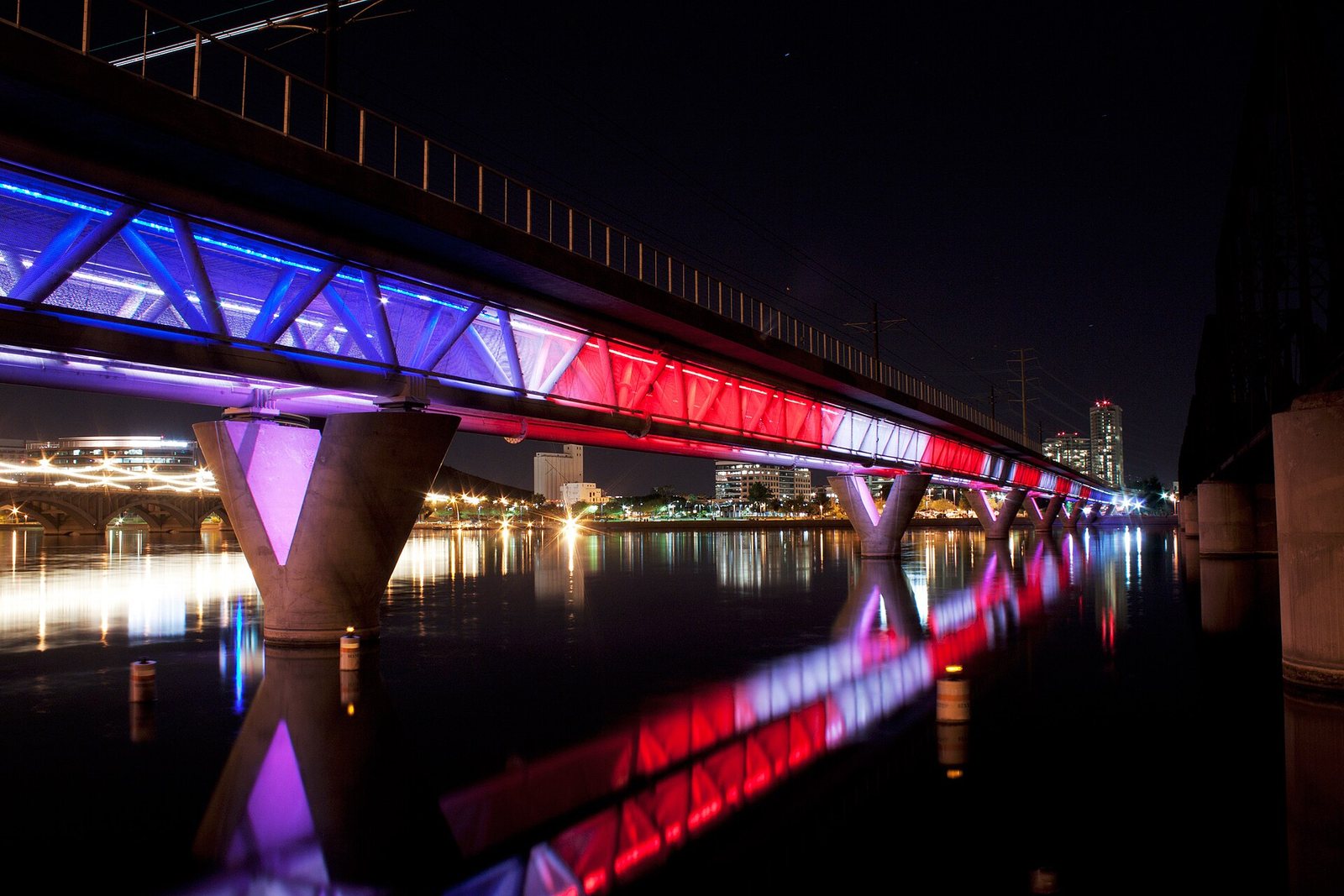
Phoenix has a light rail system, a free airport train that runs all night, free trolleys in Scottsdale, free neighborhood buses in Tempe, a streetcar, and the country’s longest-running fleet of fully driverless taxis. It is still a car city. The metro area spreads across more than 20 cities, and most of what visitors come for (Taliesin West, the Musical Instrument Museum, the trailheads, the Superstitions, the lakes) sits beyond the rails. So the useful question about getting around Phoenix isn’t whether transit exists. It’s which parts of your trip it covers, and whether those parts justify skipping the rental car.
Short answer: For most visitors, rent a car, because the Valley’s best scenery and its north Valley museums are 30 to 60 minutes apart and off the rail lines. If your trip is downtown Phoenix, Midtown, Tempe and Mesa, you can skip it: the light rail costs $2 a ride and caps at $4 a day with tap-to-pay, the airport Sky Train is free, and Waymo’s driverless cars (booked in the Waymo app, no longer through Uber) cover downtown Phoenix, Scottsdale and parts of Tempe, Mesa and Chandler (all checked October 2026).
Prices, hours and rules in this guide were last checked on October 1, 2026. Drive times are off-peak estimates; add a third or more at rush hour.
Getting around Phoenix at a glance
Every option, what it covers and what it costs, as of October 2026.
| Option | Covers | Cost (checked Oct 2026) | Best for | Doesn’t reach |
|---|---|---|---|---|
| Rental car | Everywhere | Varies; airport rentals add facility fees and surcharges | Most trips, day trips, trailheads | Nothing, but downtown parking costs extra |
| Valley Metro light rail | A Line: downtown to Sky Harbor’s 44th St stop, Tempe and Mesa. B Line: north Phoenix along Central Avenue to Baseline Road | $2 a ride; $4 a day, $20 a week, $64 a month with tap-to-pay | Downtown, Midtown museums, Tempe, Mesa | Scottsdale, Westgate, north Valley, trailheads |
| PHX Sky Train | Terminals 3 and 4, Rental Car Center, East Economy, 24th St and 44th St stations | Free, 24 hours | Airport connections | Anywhere off airport |
| Tempe Streetcar | 3.1 miles, 14 stops: Tempe Town Lake, downtown Tempe, ASU | $1 a ride | Downtown Tempe | Beyond Tempe |
| Free circulators | Scottsdale trolleys (Old Town and nearby routes); Tempe’s Orbit and FLASH shuttles | Free | Short hops in Old Town Scottsdale and Tempe | Between cities |
| Waymo driverless cars | Downtown Phoenix, Scottsdale, parts of Tempe, Mesa and Chandler; Sky Harbor curbs | Priced per trip in the app | Short trips inside the core | West Valley, foothills, outlying trailheads |
| Uber, Lyft and taxis | Everywhere | Priced per trip; rises with demand | Airport runs, late nights, event nights | Nothing, but surge pricing at events |
| Local and express buses | The street grid across the metro | $2 local; $3.25 Express and RAPID | Budget travelers with time | Fast trips |
Do you need a car in Phoenix?
Usually, yes, and the reason is geography rather than any failing of the transit system. The light rail’s two lines run through the middle of the Valley: north to south from north Phoenix down Central Avenue to downtown and on to Baseline Road, and east from downtown through the Sky Harbor stop, Tempe and Mesa. Almost everything else is a drive. Taliesin West is 43 minutes from downtown Phoenix, the Musical Instrument Museum 29, Camelback’s Echo Canyon trailhead 21, Lost Dutchman State Park 56 and Lake Pleasant 61 (checked October 2026). None of those has a rail stop, and buses that get close take a long time.
But not every trip needs one. Here’s how to decide.
| Your trip | Car? | Why |
|---|---|---|
| A convention, a game or a concert downtown, staying downtown | No | Sky Train plus light rail from the airport; everything else walkable or one stop away |
| Museums, Roosevelt Row and Tempe for 2-3 days | No | The light rail links the Heard, the Phoenix Art Museum, downtown and Tempe; Waymo fills gaps |
| A Scottsdale resort stay | Optional | Waymo and rideshare cover Old Town and many resorts; rent for a day or two of excursions |
| Hiking, Taliesin West, the MIM or the Superstitions | Yes | Trailheads and north Valley sights are off the rail lines and beyond easy rideshare range |
| Spring training at several parks | Yes | The ten parks are spread from Mesa to Surprise |
| Day trips to Sedona, Tucson or the Grand Canyon | Yes | Two to four hours each way |
A hybrid often works best: arrive by Sky Train and light rail, spend the first days car-free in the center, then rent a car for the days you head to the mountains, the north Valley or out of town. You save on rental days and on hotel parking, and you avoid driving where the rail line already goes. Before you settle on a base, our guide to Phoenix neighborhoods shows how far apart the Valley’s cities really are.
How does the Phoenix light rail work?
Valley Metro’s light rail has run as two lines since June 2025, when the South Central extension opened. The A Line runs east-west from the Downtown Hub through the 44th Street/Washington station, where it meets the PHX Sky Train, then through Tempe and along Main Street in Mesa to Gilbert Road. The B Line runs north-south from Metro Parkway in north Phoenix down 19th Avenue and Central Avenue, through Uptown, Midtown and downtown, to Baseline Road in south Phoenix. You change lines at the Downtown Hub.
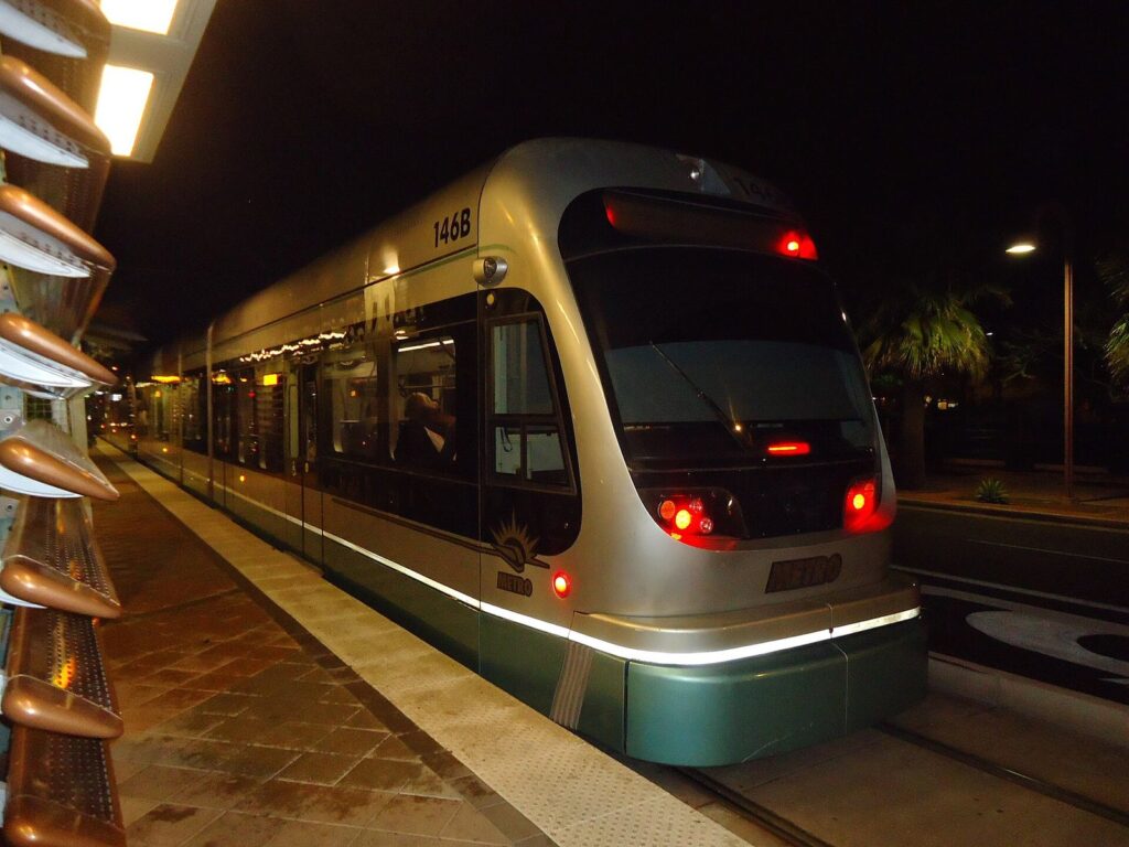
Trains come often enough that you don’t need a timetable during the day. Valley Metro lists weekday service every 12 minutes until 7 p.m. and every 20 minutes after that, Saturday service every 15 minutes until 7 p.m., and Sunday service every 20 minutes all day. The first full trips leave the end-of-line stations between about 4:30 and 5:30 a.m., and the last full trips start between 10:50 p.m. and 12:10 a.m., so check the hours of service before a late night out; a train that leaves the end of the line late may not run the full route (checked October 2026).
Fares are simple (checked October 2026). A single ride on light rail or a local bus costs $2, and the reduced fare is $1. If you tap a contactless bank card or phone, or use Valley Metro’s Copper card or app, your fares cap automatically at $4 a day, $20 for a Monday-to-Sunday week and $64 a calendar month, so a busy day never costs more than two rides. Children 5 and under ride free with a fare-paying adult. Ignore older blog posts that quote a $3.50 day pass; with tap-to-pay, fares now cap at $4 a day automatically. You can bring a bicycle on board.
For visitors, the useful stretches are clear. Central Avenue stations put you at the door of the Heard Museum, the Phoenix Art Museum, the Burton Barr Central Library and Roosevelt Row. Downtown stops serve Chase Field, Mortgage Matchup Center and the convention center. The 44th Street station connects to the airport, and the A Line continues to Tempe’s Mill Avenue, ASU and downtown Mesa, including the Center/Main stop by the Mesa Arts Center. What the rail doesn’t serve is just as important: Scottsdale, Papago Park, the Glendale stadiums and every major trailhead.
What are the free and cheap ways to get around?
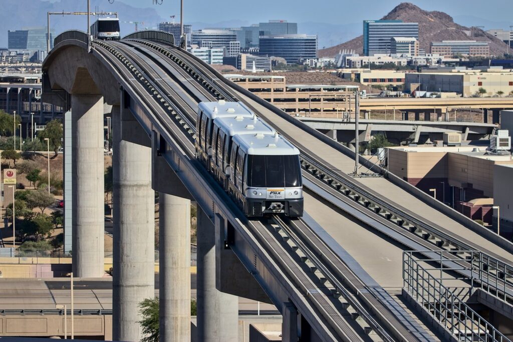
The PHX Sky Train. Free and running 24 hours a day, it links Terminals 3 and 4, the Rental Car Center, East Economy parking, the 24th Street station and the 44th Street light rail station, every 3.5 to 7 minutes from 5 a.m. to 10 p.m. (checked October 2026). The ride from 44th Street to the Rental Car Center takes about 13 minutes. For terminal-by-terminal details, see our Sky Harbor airport guide.
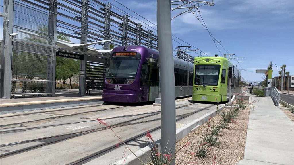
Tempe’s streetcar and free shuttles. The Tempe Streetcar runs 3.1 miles past 14 stops on Mill and Ash avenues, from Rio Salado Parkway and Marina Heights to Dorsey Lane and Apache Boulevard, every 15 to 20 minutes, for $1 a ride. The City of Tempe also runs six free Orbit neighborhood circulators (Mercury, Venus, Earth, Mars, Jupiter and Saturn) seven days a week, most every 15 minutes and every 30 on Sundays, plus a free FLASH shuttle; Orbit buses use flag zones, so you can wave one down wherever it’s safe to stop (checked October 2026).
Scottsdale’s trolleys. Scottsdale runs free trolleys, including an Old Town route listed as running every 15 minutes from 10 a.m. to 9 p.m. and neighborhood routes (Miller/Hayden, Mustang and 68th Street/Camelback) on weekdays from roughly 5:50 a.m. to 7:10 p.m. The neighborhood routes don’t run on six major holidays, and during spring training the city adds a free trolley to Scottsdale Stadium (checked October 2026). For a stay in or near Old Town, they’re the easiest way to get between galleries, restaurants and Scottsdale Fashion Square without moving a car.
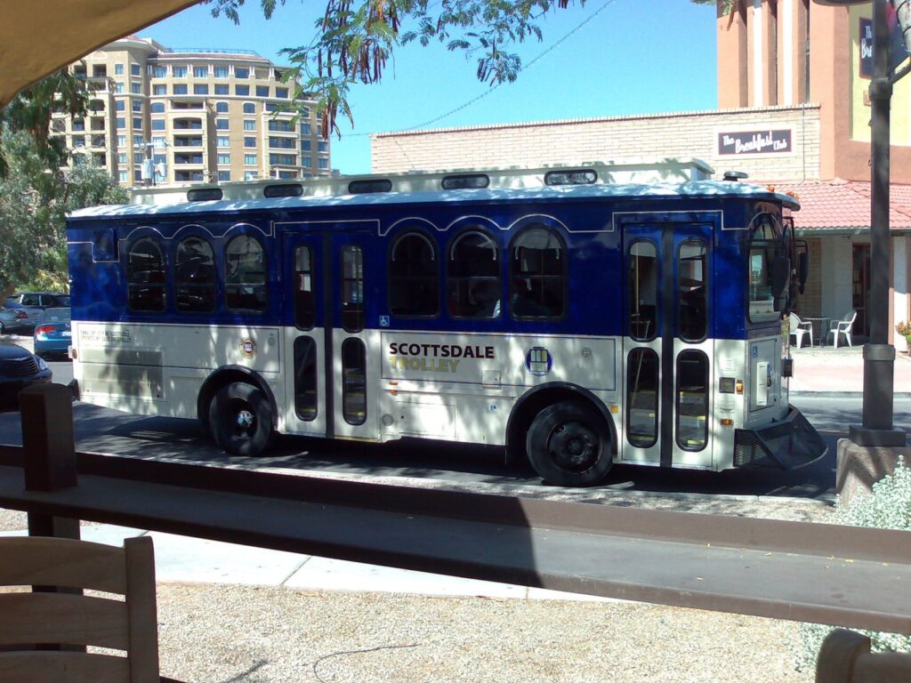
Buses. Valley Metro’s local buses follow the mile-by-mile street grid across the metro for $2, and Express and RAPID commuter buses cost $3.25 (checked October 2026). They reach places the rail doesn’t, but slowly; for a visitor on a short trip, they make sense for a specific route, not as the backbone of a plan.
How do Waymo’s driverless cars work for visitors?
Waymo opened fully driverless rides to the public in metro Phoenix in 2020, its first market, and in December 2022 Sky Harbor became the first airport in the world to offer autonomous vehicle service. In October 2026, Waymo’s Phoenix page describes its territory as downtown Phoenix, Scottsdale and parts of Tempe, Mesa and Chandler, and directs riders to the in-app map for exact boundaries. At the airport, you meet the car at the Terminal 3 and Terminal 4 outer curbs on Level 1 or at the 24th Street and 44th Street Sky Train stations.
Three things to know before you rely on it. First, you can no longer book a Waymo through Uber in Phoenix; the partnership ended in June 2026, so download the Waymo app and set up payment before you land. Second, riders under 18 need a teen account, so families with teenagers should read the app’s rules first. Third, check the service map for each trip rather than assuming: the core of the Valley is covered, but outlying trailheads, the West Valley and the foothill towns aren’t, so a ride out to the edge may need a conventional rideshare for the return.
Prices are set per trip in the app and move with demand, distance and time. Waymo is at its best for the short hops visitors make most often: airport to downtown, downtown to Roosevelt Row late at night, around Old Town Scottsdale, and between Tempe and downtown Phoenix.
What about Uber, Lyft and taxis?
Conventional rideshare covers the whole metro around the clock, which makes it the fallback for everything Waymo and the rail don’t reach. At Sky Harbor, rideshare pickups run 24 hours at Terminal 3, Terminal 4 and the 24th Street and 44th Street Sky Train stations, and taxis wait at Terminals 3 and 4 (checked October 2026). Fares are set by the apps and rise with demand, especially when games and concerts let out downtown or at Westgate, so walking a few blocks away from the venue before you request a ride can save money and time.
Because prices move by the minute, the distances are the better planning tool. These are the trips visitors take most, measured off-peak.
| Trip | Distance | Off-peak drive (checked Oct 2026) |
|---|---|---|
| Sky Harbor Terminal 4 to downtown Phoenix | About 5-6 miles | 15 min |
| Sky Harbor Terminal 4 to Tempe’s Mill Avenue | About 5-8 miles | 15 min |
| Sky Harbor Terminal 4 to Old Town Scottsdale | About 9-12 miles | 22 min |
| Downtown Phoenix to Old Town Scottsdale | 12.8 miles | 21 min |
| Tempe’s Mill Avenue to Old Town Scottsdale | 5.7 miles | 11 min |
| Old Town Scottsdale to the Desert Botanical Garden | 4.0 miles | 9 min |
| Old Town Scottsdale to Taliesin West | 13.9 miles | 25 min |
| Downtown Phoenix to the Musical Instrument Museum | 21.0 miles | 29 min |
| Downtown Phoenix to Westgate and State Farm Stadium | 17.4 miles to Westgate | 24 min |
How do you reach the main sights without a car?
Here’s the practical version: for each place most visitors want to see, the easiest car-free way to get there and how long the same trip takes by car off-peak (checked October 2026).
| Destination | Without a car | By car from downtown Phoenix |
|---|---|---|
| Heard Museum, Phoenix Art Museum, Burton Barr Central Library | B Line light rail to the Central Avenue stops | 3-6 min |
| Chase Field, Mortgage Matchup Center, convention center | Light rail to the downtown stops | 2-3 min |
| Roosevelt Row | B Line, or walk from downtown | 3 min |
| Tempe Town Lake, Mill Avenue, ASU | A Line, then the Tempe Streetcar | 17-18 min |
| Downtown Mesa and the Mesa Arts Center | A Line to the Center/Main stop | 27 min |
| Desert Botanical Garden, Phoenix Zoo, Hole-in-the-Rock | Waymo or rideshare | 17-20 min |
| Old Town Scottsdale | Waymo or rideshare, then the free trolley | 21 min |
| Camelback Mountain trailheads | Rideshare drop-off at dawn | 21-22 min |
| Musical Instrument Museum | Rideshare (about 21 miles) | 29 min |
| Taliesin West | Rideshare or a tour | 43 min |
| State Farm Stadium and Westgate | Rideshare; no rail | 24 min |
| Lost Dutchman State Park and the Superstitions | Car or tour only | 56 min |
The pattern is easy to remember. Everything along Central Avenue, downtown, Tempe and Mesa works by rail. Papago Park and Old Town Scottsdale are short Waymo or rideshare hops. Anything in the north Valley or out in the desert is a car or a tour, and the further out you go, the more a round-trip rideshare costs compared with a day’s rental.
How do you get around on game and event days?
Downtown events are the light rail’s best moment. Chase Field and Mortgage Matchup Center sit a short walk from downtown stations, and trains beat both traffic and event parking prices, though they fill up when a game lets out, so expect a wait for a train with room. If you drive, buy parking ahead where the venue sells it, and leave extra time on the freeways before and after. The NBA All-Star weekend on February 19 to 21, 2027 will bring the same crowds downtown on a bigger scale.
Westgate in Glendale, home of State Farm Stadium and Desert Diamond Arena, has no rail connection, so it’s a car or a rideshare. Event traffic there can double the normal 24-minute drive from downtown, and rideshare prices rise sharply as crowds leave. A meal or a drink nearby while the lots empty is often faster than joining the queue. In spring training, Scottsdale’s free trolley to Scottsdale Stadium is the easiest way to that park; for the rest of the Cactus League, plan on driving.
How does the heat change getting around?
From May to September, the walk to the station matters as much as the ride. Rail platforms have shade structures, but bus stops often don’t, and a 10-minute wait at 3 p.m. in July is genuinely hard on the body. In the hottest months, time transit trips for mornings and evenings, carry water on every ride, and use Waymo or a rideshare for the door-to-door legs in the middle of the day.
Cars need attention too. A parked car in summer sun gets dangerously hot within minutes, so never leave anyone inside, and keep a sunshade up whenever you park. Carry extra water in case of a breakdown on a long drive, keep your fuel tank from running low on trips into the desert, and remember that afternoon monsoon storms can close roads with flooding or dust. For more on desert safety, the heat rules in this guide’s driving section apply to every trip you take.
Which base gives you the best transport options?
Where you stay decides how much you’ll need a car. Downtown Phoenix has both light rail lines, the Sky Train connection and walkable sports and arts districts, so it’s the easiest car-free base. Tempe has the A Line, the streetcar and free Orbit buses, plus an 11-minute drive to Old Town Scottsdale. Old Town Scottsdale has free trolleys and Waymo coverage but no rail, so you’ll use rideshare or Waymo to reach Phoenix. The Biltmore area and the Camelback corridor sit beyond the rail lines, and north Phoenix around Desert Ridge, the foothill towns and the West Valley are car country. Our guide to the Valley’s cities and neighborhoods compares each area’s drive times in detail.
What do families need to know about car seats and transit?
Arizona requires children under 8 who are shorter than 4 feet 9 inches to ride in a child restraint or booster seat, and that applies in rental cars, taxis and rideshares alike. Rental companies rent car seats for a daily fee, but many families find it cheaper and safer to bring their own; airlines generally check them free. On transit, children 5 and under ride free with a fare-paying adult, folding strollers make light rail and streetcar trips easy, and if teenagers will ride Waymo, check its rules first, because riders under 18 need a teen account.
What does a day of getting around cost?
Compare two ordinary days for two people, using October 2026 prices. On a car-free day built around downtown, Midtown and Tempe, each of you taps a card on the light rail and hits the $4 daily cap, so rail fares total $8 however many rides you take; the Sky Train is free, and you add whatever one or two Waymo or rideshare hops to Papago Park or Old Town Scottsdale cost that day. On a car day, the rental and fuel are the big costs, and parking is small change in most places: three hours at a downtown Phoenix meter costs $4.50, Old Town Scottsdale’s city lots and garages are free, and city trailheads charge nothing.
That’s why the hybrid plan wins for many trips. Spend the central days on the rail and pay for a rental only on the days you’re heading for the trailheads, the north Valley or a day trip, when it saves hours rather than dollars.
How do you get from Phoenix to Scottsdale?
There’s no train between them, so it’s a drive. Old Town Scottsdale is 21 minutes and 12.8 miles from downtown Phoenix off-peak, 11 minutes from Tempe’s Mill Avenue and 16 to 22 minutes from Sky Harbor, depending on the terminal (checked October 2026). Because Waymo’s service area includes both downtown Phoenix and Scottsdale, a driverless ride is a realistic option for the trip, and conventional rideshare covers it at any hour. Once you’re in Old Town, the free trolley and your feet handle the rest. If you’ll make the trip more than once a day, or go on to Taliesin West or north Scottsdale, a rental car starts to make sense.
What should you know about driving in Phoenix?
Driving here is straightforward once you know the grid. Central Avenue divides numbered Streets to the east from numbered Avenues to the west, the big east-west roads come every mile, and the freeways (I-10, I-17, SR 51, US 60 and Loops 101, 202 and 303) handle the long hauls. Off-peak, a cross-town drive is fast. At weekday rush hours, add a third or more to every drive time, and expect far worse around big events.
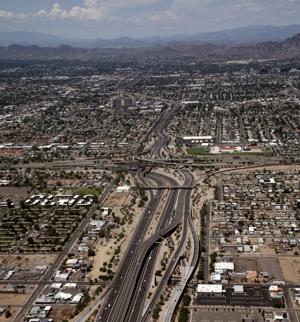
A few rules catch visitors out. The HOV lanes on Valley freeways are restricted Monday to Friday from 6 to 9 a.m. and 3 to 7 p.m. to vehicles with two or more people, motorcycles and buses, according to the Arizona Department of Transportation (checked October 2026); outside those hours anyone can use them. Arizona has banned handheld phone use while driving since 2021, so mount your phone and use hands-free navigation. There are no toll roads anywhere in the state. Several Valley cities use photo enforcement cameras for speed and red lights, so assume a posted limit is enforced.
The desert adds its own hazards. The grid runs east-west, so at sunrise and sunset you’ll often drive straight into the sun; keep sunglasses handy and leave room ahead. From June 15 to September 30, monsoon storms bring dust storms and flash floods. If a dust storm cuts visibility, the state’s advice is to pull off the road as far as you can, turn off all your lights, set the parking brake, take your foot off the brake pedal and stay buckled. Never drive into a flooded wash or around a barricade; Arizona’s so-called Stupid Motorist Law lets agencies bill drivers for their rescue.
Heat changes the car itself. In summer, use a windshield sunshade, keep a towel for the steering wheel and seat belt buckles, carry water in the car, and never leave a person or a pet inside, even briefly. Gate times matter too: South Mountain’s entrance and the Papago Park lot by Hole-in-the-Rock close at 7 p.m., Piestewa Peak’s lot opens at 5 a.m., and on the fourth Sunday of every month South Mountain’s Summit Road is closed to cars all day (checked October 2026).
Where can you park, and what does it cost?
Downtown Phoenix. On-street meters cost $1.50 an hour and are enforced from 8 a.m. to 10 p.m. every day, including weekends and holidays; parking at meters is free overnight, from 10 p.m. to 8 a.m., according to the city’s listing (checked October 2026). Garages and surface lots fill the gaps, and on event nights prices jump. Mortgage Matchup Center has more than 700 on-site spaces with rates that vary by event and can be bought ahead online.
Old Town Scottsdale. City public parking in Old Town is free, with time limits (commonly three hours) on many surface spaces and lots, and the garages are the place for longer stays. The city’s parking map lists 24 public lots and garages, including the Scottsdale Fashion Square garages, the Waterfront underground garage and the Civic Center Library garage.
Trailheads and parks. Most city trailhead parking is free, but space is the problem. Camelback’s Echo Canyon lot holds few cars and is typically full from late morning to early afternoon on winter and spring weekdays and all day on weekends, and police ticket drivers who idle on McDonald Drive or Tatum Boulevard waiting for a space. Arrive at dawn, use a rideshare or Waymo for the drop-off if it covers your trailhead, or hike Piestewa Peak instead.
The airport. Sky Harbor’s terminal garages, economy lots and valet each have their own rates, covered in our guide to Phoenix Sky Harbor parking and terminals. For a short trip, the light rail and Sky Train often beat paying to park at all.
How should you rent a car in Phoenix?
Most visitors pick up at Sky Harbor’s Rental Car Center, where more than 10 rental companies operate; it’s a Sky Train ride from both terminals, and it’s 9 minutes’ drive from downtown Phoenix (checked October 2026). Airport rentals carry extra daily facility charges, an airport concession recovery fee and county and state taxes on top of the base rate, and Maricopa County’s car-rental taxes have historically ranked among the highest in the country, so compare the all-in total, not the advertised daily price.
Three strategies keep the cost down. Rent only for the days you need a car, picking up at an off-airport or hotel-based location if your first days are car-free. Skip the rental company’s fuel plan unless you’re catching an early flight and won’t have time to fill up. And think about where you’ll park: downtown hotels and resorts may charge a daily parking or valet fee, while many suburban hotels park free. In summer, pick a light-colored car if you have the choice, and check the air conditioning before you drive off the lot.
Can you bike or walk around Phoenix?
In the right places and seasons, yes. Downtown Phoenix, Roosevelt Row, Tempe’s Mill Avenue and Old Town Scottsdale are compact and walkable, and the Valley’s canal paths and Tempe Town Lake give cyclists long, flat, car-free routes. Bikes ride on the light rail, which makes a one-way ride and a train back possible.
The limit is heat, not infrastructure. From May to September, walking or cycling any distance belongs to the hour after sunrise and the evening, and even in winter, sun and dry air mean you should carry water on a ride of any length. Distances between the Valley’s cities are also long; a ride from Tempe to Old Town Scottsdale is pleasant, but Scottsdale to downtown Phoenix is a commute, not a sightseeing loop.
Getting around with a disability
The light rail’s low-floor trains and stations are built for wheelchair access, and Valley Metro’s buses kneel and carry ramps. For door-to-door service, federal ADA rules let a visitor who is paratransit-eligible at home, or who has a disability that prevents using regular transit, use the local paratransit service for up to 21 days in a 365-day period, with documentation of eligibility or residence; contact Valley Metro ahead of your trip to arrange it. At the airport, the Sky Train is step-free, and Sky Harbor runs a Sensory Room in Terminal 4 and a Compassion Cacti lanyard program for travelers with hidden disabilities.
Plan around the heat as well as the access. Metal parts of wheelchairs and mobility aids and dark seat surfaces get hot enough to burn in summer, so keep them shaded, and build in air-conditioned stops between legs of a trip. If you’ll rent a car with hand controls or need an accessible vehicle, request it well before you arrive, because availability is limited.
What to skip
The transport mistakes that waste the most time or money, as of October 2026:
- A rental car for a downtown-only trip. The Sky Train and light rail cover airport-to-downtown for $2, and you’ll pay to park the car you don’t use.
- Booking Waymo through Uber. It no longer works in Phoenix. Use the Waymo app.
- Counting on the last train. The last full trips start between 10:50 p.m. and 12:10 a.m., and late trains may not run the full route. Plan a ride home after late concerts.
- Driving to Camelback at 9 a.m. on a weekend. The Echo Canyon lot is typically full all day on winter and spring weekends, and idling on nearby streets gets you a ticket.
- The HOV lane alone at rush hour. Solo drivers in HOV lanes from 6 to 9 a.m. and 3 to 7 p.m. on weekdays risk a fine.
- Old blog advice on transit passes. The $3.50 day pass is gone; tap-to-pay caps at $4 a day.
- Driving through a dust storm or a flooded wash. Pull aside and stop, or turn around.
Frequently Asked Questions
Do you need a car to visit Phoenix?
For most trips, yes. The light rail covers downtown Phoenix, the Central Avenue museums, Tempe, Mesa and the airport, but Taliesin West, the Musical Instrument Museum, the trailheads, the Superstitions and day trips need a car. If you’re staying downtown or in Tempe for two or three days of museums and food, you can manage with the light rail, the free Sky Train and Waymo.
How much does the light rail cost in Phoenix?
A single ride costs $2, or $1 at the reduced fare (checked October 2026). If you tap a contactless card or phone, or use the Copper card or app, fares cap at $4 a day, $20 a week and $64 a calendar month. Children 5 and under ride free with a paying adult. The Tempe Streetcar costs $1, and Express and RAPID buses cost $3.25.
Is there public transportation from Phoenix Sky Harbor to downtown?
Yes. Take the free PHX Sky Train from Terminal 3 or 4 to the 44th Street/Washington station, then ride the A Line light rail west to downtown for $2. The Sky Train runs 24 hours a day, every 3.5 to 7 minutes from 5 a.m. to 10 p.m., and light rail runs from about 4:30 a.m. to around midnight (checked October 2026).
Can you use Waymo in Phoenix?
Yes. Waymo’s driverless cars serve downtown Phoenix, Scottsdale and parts of Tempe, Mesa and Chandler, with pickups at Sky Harbor’s Terminal 3 and 4 curbs and the 24th and 44th Street Sky Train stations. Book in the Waymo app: since June 2026 you can no longer book Waymo through Uber in Phoenix. Riders under 18 need a teen account.
Is parking free in Phoenix?
Not downtown during the day. City meters cost $1.50 an hour from 8 a.m. to 10 p.m. every day, and are free overnight (checked October 2026). Old Town Scottsdale’s city lots and garages are free, with time limits on many surface spaces. Most trailhead and park lots are free, though Camelback’s fill early. Hotels, resorts and event venues set their own parking charges.
Are there toll roads in Phoenix?
No. Arizona has no toll roads, so the Valley’s freeways, including I-10, I-17, SR 51, US 60 and Loops 101, 202 and 303, are free to drive. The only lane restrictions to know are the HOV lanes, which require two or more people in the car on weekdays from 6 to 9 a.m. and 3 to 7 p.m.
Is Phoenix walkable?
Parts of it are. Downtown Phoenix, Roosevelt Row, the Central Avenue museum corridor, Tempe’s Mill Avenue and Old Town Scottsdale are walkable, and the light rail links several of them. The rest of the Valley is spread out, with long blocks and few shaded sidewalks, and from June to September walking any distance belongs to early mornings and evenings.
How do you get from Phoenix to Scottsdale without a car?
Take a Waymo or a rideshare: there’s no light rail to Scottsdale. Old Town Scottsdale is 21 minutes from downtown Phoenix and 11 minutes from Tempe off-peak, and Waymo’s service area includes both downtown Phoenix and Scottsdale. Once in Old Town, use the free Scottsdale trolley, which is listed as running every 15 minutes from 10 a.m. to 9 p.m.
Related Phoenix Guides
- Phoenix Sky Harbor Airport: terminals, parking rates, the Sky Train and every way into town.
- Phoenix Neighborhoods and Valley Cities Explained: what each part of the Valley is for, with drive times between them.
Sources and verification
This guide is built from research, not hosted visits. Fares, hours, rules and parking details were checked on October 1, 2026 (some on September 23-24) against the agencies and operators listed below. Drive times and distances are off-peak estimates from OSRM routing on OpenStreetMap data.
- Valley Metro: hours of service, light rail, two-line system, Tempe Streetcar, 2026 fare policy
- Phoenix Sky Harbor: PHX Sky Train, ground transportation, media kit
- Waymo: Phoenix service, FAQ
- City of Phoenix: parking services, Camelback Mountain, South Mountain Park and Preserve
- City of Tempe: Orbit; City of Scottsdale: trolley, trolley guide
- Arizona Department of Transportation: HOV lanes; Arizona Legislature: A.R.S. 28-910; federal ADA paratransit rule: 49 CFR 37.127
- Venues: Mortgage Matchup Center
Photo Credits
- Valley Metro light rail train: photo by Tomwsulcer, Wikimedia Commons (CC0)
- PHX Sky Train: photo by Hunter Trick (TrickHunter), Wikimedia Commons (CC BY-SA 4.0)
- Light rail and Tempe Streetcar at Dorsey Lane: photo by Dbrant06, Wikimedia Commons (CC BY-SA 4.0)
- Scottsdale trolley: photo by Adriao, Wikimedia Commons (CC BY-SA 4.0)
- I-10, SR 51 and Loop 202 interchange: photo by Doc Searls from Santa Barbara, USA, Wikimedia Commons (CC BY 2.0)
- Light rail bridge over Tempe Town Lake (featured image): photo by Alan Stark, Wikimedia Commons (CC BY-SA 2.0)