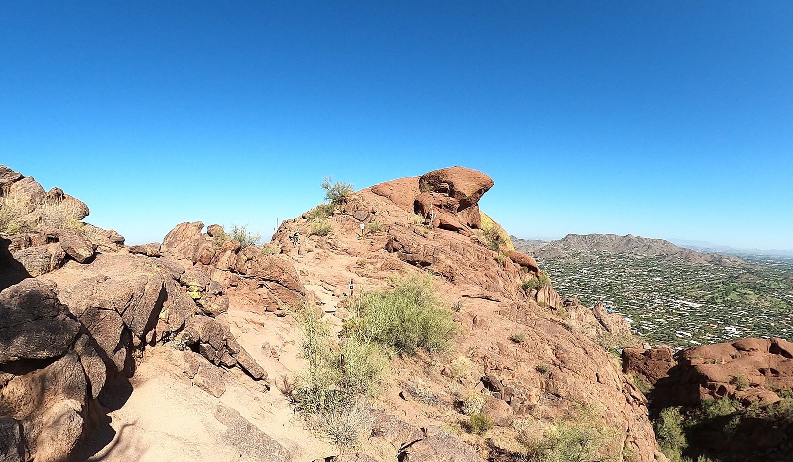
On a winter weekday, the parking lot at Camelback Mountain’s Echo Canyon trailhead is usually full from late morning to early afternoon, and on winter weekends it can be full all day. On a July day with an Extreme Heat Warning, the same trail is off-limits from 8 a.m. to 5 p.m. by city rule. Hiking in Phoenix is superb, with real mountains inside the city limits and trailheads 20 minutes from downtown, but it runs on two clocks, parking and heat, and visitors who ignore either one either don’t get on the trail or get into trouble on it. This guide is about both, and about which trail to pick when you have one free morning.
Short answer: With one free morning from October to April, climb Piestewa Peak (1.2 miles one way, 1,200 feet up) or Camelback’s Echo Canyon Trail (1.14 miles, 1,400 feet) at sunrise, or walk Pinnacle Peak’s 2-mile trail in north Scottsdale if you want views without a scramble. Carry about a liter of water for every hour you’ll be out when it’s hot, plus something salty. From June to September, hike only at first light, and expect the big summit trails to be closed from 8 a.m. to 5 p.m. on Extreme Heat Warning days.
Trail rules, hours, fees and parking details in this guide were last checked on September 24, 2026. Drive times are off-peak estimates from downtown Phoenix unless noted.
Hiking in Phoenix at a glance
These are the trails and parks most visitors choose between, with the numbers that decide the choice. Distances and difficulty ratings come from the cities that run the trails where they publish them.
| Trail or park | Where; drive from downtown | Length and climb | Heat restriction? | Cost and hours (checked Sept 2026) |
|---|---|---|---|---|
| Piestewa Peak Summit Trail | Phoenix Mountains Preserve; 17-18 min | 1.2 mi one way; 1,200 ft; rated extremely difficult | Yes | Free; trails 5 a.m.-11 p.m., parking 5 a.m.-7 p.m. (9 p.m. June-Sept) |
| Camelback: Echo Canyon Trail | Arcadia, east Phoenix; 21-22 min | 1.14 mi one way; 1,400 ft; extremely difficult | Yes | Free; sunrise to sunset; lot fills early |
| Camelback: Cholla Trail | Paradise Valley side | 1.5 mi one way; 1,420 ft; extremely difficult | Yes | Free; street parking only |
| South Mountain Park and Preserve | South Phoenix; about 19 min | 100+ miles of trails | A few trails | Free; parking 5 a.m.-7 p.m., trails 5 a.m.-11 p.m. |
| Papago Park: Hole-in-the-Rock | East Phoenix; 17 min | 0.2 mi; easy | No | Free; lot 5 a.m.-7 p.m. |
| Phoenix Sonoran Preserve | North Phoenix; about 45 min | 36 miles from three trailheads | No | Free |
| McDowell Sonoran Preserve | North Scottsdale; 40 min (24 from Old Town) | 230+ miles of trails | No city restriction | Free; sunrise to sunset |
| Pinnacle Peak Park | North Scottsdale; 47-48 min (34-35 from Old Town) | 2 mi one way; 1,300 ft total climb | No | Free; hours change by season; no dogs |
| Usery Mountain Regional Park | East of Mesa; 46 min (36 from Tempe) | Desert trails including Wind Cave | No | $10 per vehicle |
| White Tank Mountain Regional Park | Far West Valley; 61 min | Desert trails including the Waterfall Trail | No | $10 per vehicle |
| Lost Dutchman State Park | Superstition Mountains; 56 min | Desert loops to steep climbs | No | $10-$20 per vehicle |
When are Phoenix trails closed?
Phoenix closes some of its own trails for heat. Under rules the City Council approved on March 27, 2025, on any day the National Weather Service issues an Extreme Heat Warning, the city’s most popular and most dangerous summit trails are off-limits from 8 a.m. to 5 p.m. The city’s word is “restricted”, and it means you can’t be on them.
The restricted trails are Camelback Mountain’s Echo Canyon and Cholla trails; the Piestewa Peak Summit Trail and the trails that connect to it; and, at South Mountain, the Holbert Trail (2.56 miles), the Mormon Trail (1.35 miles), the Hau’pal Loop (2.8 miles) and the National Trail where you reach it from the Pima Canyon trailhead. Fewer than 7 of South Mountain’s 100-plus trail miles are covered, so easier trails elsewhere in the preserves stay open, though that doesn’t make them a good idea at midday (checked September 2026).
The rule gets used. In 2024 the city restricted those trails on 45 days between May 1 and October 13, a year when Phoenix hit 105°F or higher on 121 days and topped 110°F on 69. According to the city, rescues on the restricted trails fell from 57 in 2021 to 47 in 2022, 30 in 2023 and 35 in 2024. More than 200 hikers are rescued from Phoenix’s desert parks and preserves in a typical year, and the fire department’s crews do those rescues in the same heat that caused them.
What are the regular trail hours?
Outside heat days, each park keeps its own hours. Camelback’s trailheads and trails are open from sunrise to sunset. Piestewa Peak’s trails are open 5 a.m. to 11 p.m., with the park entrance and parking open 5 a.m. to 7 p.m., extended to 9 p.m. from June 1 to September 30. South Mountain’s entrance and parking are open 5 a.m. to 7 p.m. and its trails 5 a.m. to 11 p.m., and its Summit Road closes to cars all day on the fourth Sunday of each month and from 5 to 10 a.m. on the other Sundays. Papago Park’s Hole-in-the-Rock lot is open 5 a.m. to 7 p.m. Scottsdale’s McDowell Sonoran Preserve is open sunrise to sunset, and Pinnacle Peak Park posts hours that change through the year and starts closing its trail an hour before the posted closing time (all checked September 2026).
What are the rules for dogs?
Leave the dog at the hotel for the big summits. Dogs are banned year-round on every Camelback trail and on the Piestewa Peak Summit Trail, and on all City of Phoenix trails whenever it’s above 100°F. Where dogs are allowed, the city requires a leash no longer than 6 feet and asks you to test the ground with your hand for 10 seconds: if it’s too hot for your palm, it’s too hot for paws. In Scottsdale’s McDowell Sonoran Preserve, dogs must be on a handheld leash of 6 feet or less, and the city says that if it’s over 90 degrees at any point in your hike, it’s too hot for your dog. Pinnacle Peak doesn’t allow dogs at all.
How much water do you need to hike in Phoenix?
More than you think, and the official advice says exactly that. The City of Phoenix’s “Take a Hike. Do it Right.” checklist tells hikers to drink before they start and carry more water than they expect to need, and the National Park Service’s hot-weather guidance for the Grand Canyon puts a number on it: about one quart, or roughly a liter, for every hour of hiking on a hot, dry day, with salty snacks or an electrolyte drink to replace the sodium you sweat out.
Do the math before you leave the car. If a summit round trip will take you two hours in warm weather, that’s about two liters, and a third is cheap insurance. Most day packs hold that easily; a single bottle from the hotel lobby doesn’t. Use the old desert rule to decide when to turn around: when half your water is gone, head back, whether or not you’ve reached the top. On a cool January morning you’ll drink far less, but the round trip on a hard summit trail still takes longer than its mileage suggests, because 1,200 to 1,400 feet of climbing in little more than a mile is steep.
At 105°F, no amount of water makes a midday summit safe. That’s the point of the city’s 8 a.m. to 5 p.m. trail heat restriction: on the hottest days the body can’t shed heat fast enough on exposed rock, however much you drink. In summer, the rule is to be off the mountain by mid-morning, not to carry more water up it at noon.
How long does each hike take, and how much water is that?
Mileage alone misleads on Phoenix’s steep summits, so use Naismith’s rule, the old hiker’s estimate of an hour for every 3 miles plus an hour for every 2,000 feet of climbing, and then add time for rest stops and the descent on loose rock. It gives realistic moving times, and multiplying by the National Park Service’s hot-weather figure of about a liter an hour gives you the minimum water to carry on a warm day.
| Round trip (city distances, 2026) | Distance and climb | Moving time by Naismith’s rule | Water on a hot day |
|---|---|---|---|
| Piestewa Peak Summit Trail | 2.4 mi; 1,200 ft | About 1 hr 25 min, plus stops | At least 1.5-2 liters |
| Camelback, Echo Canyon | 2.3 mi; 1,400 ft | About 1 hr 30 min, plus stops | At least 1.5-2 liters |
| Camelback, Cholla | 3.0 mi; 1,420 ft | About 1 hr 45 min, plus stops | At least 2 liters |
| Pinnacle Peak, end and back | 4.0 mi; 1,300 ft total | About 2 hr, plus stops | At least 2-2.5 liters |
| Hole-in-the-Rock | 0.4 mi | About 15 min | A bottle |
Those are moving times for a reasonably fit adult. Beginners, families and anyone who stops for photos should add half again, and the water should rise with the time. On a 60-degree January morning you won’t drink that much, but carry it anyway; the extra weight costs you nothing, and running dry on a steep descent costs a lot.
What else goes in the pack?
The city’s checklist covers the basics: proper shoes with grip, a hat, sunscreen and a charged phone. Hike with someone if you can, and if you’re alone, tell someone which trail you’re on and when you expect to be back. Start early enough that you’re walking in shade or low sun, and plan to finish before the heat builds. If you or someone with you starts to feel dizzy, sick or confused, stop, get into shade, cool off and call 911 rather than pushing on.
Which Phoenix hike should you do with one free morning?
Pick by three things: your fitness, where you’re staying and the month. The table sorts the most common situations.
| If you are… | Hike | Why |
|---|---|---|
| Fit, staying central, October to April | Piestewa Peak Summit Trail | The classic Phoenix summit; 8 min from the Camelback corridor; parking spread along the park road |
| Fit and after the famous one | Camelback, Echo Canyon | The best-known summit, at 2,704 ft; arrive at sunrise for parking |
| Staying in Scottsdale | Pinnacle Peak, or Gateway at McDowell Sonoran | Well-marked trails with big views and gentler grades |
| With kids or short on time | Hole-in-the-Rock, Papago Park | A 0.2-mile walk to a sandstone window over the city |
| Want miles without crowds | South Mountain away from the restricted trails | 100+ miles of trail; only a few are restricted in heat |
| Visiting June to September | A short, low trail at first light | Sunrise is as early as 5:18 a.m.; be done by 8 or 9 |
For most first-time visitors, Piestewa Peak is the better of the two big summits. The climb is shorter in height than Camelback’s, the trail is an engineered path rather than a scramble over boulders, and parking is spread along the park road instead of crammed into one small lot. Camelback is the more famous mountain and the tougher climb, with steep rock sections and a handrail on the Echo Canyon side; do it if you’re fit, you’re there at sunrise and you know the parking lot may already be full.
The best hikes in Phoenix, trail by trail
Piestewa Peak
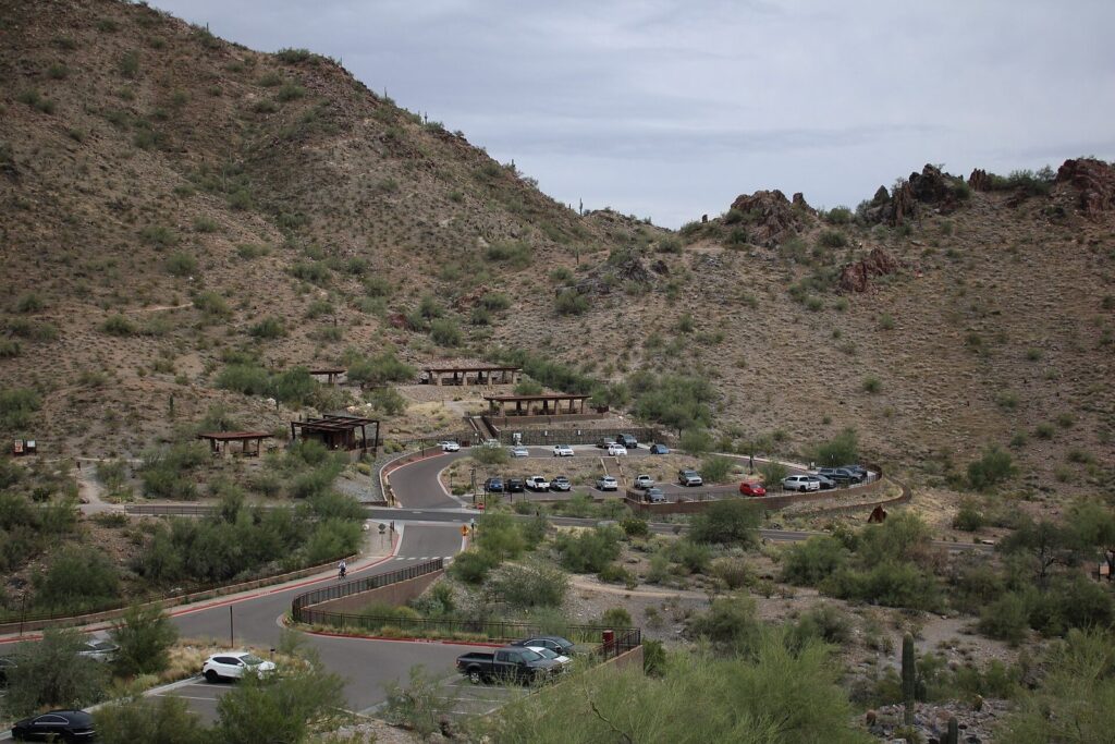
Phoenix Mountains Preserve, north-central Phoenix. 17-18 minutes from downtown, 8 from the Camelback corridor. The Summit Trail climbs 1,200 feet in 1.2 miles to a peak about 2,608 feet high, and the city rates it extremely difficult, which surprises people who read the mileage and not the elevation. It is steep from the first step, mostly on rock steps and switchbacks, and busy at sunrise with locals doing their daily climb. The view from the top takes in downtown, Camelback and the whole central Valley. Trails open at 5 a.m.
The peak was renamed in 2003 for Lori Piestewa, a Hopi soldier who was the first Native American woman in the U.S. military known to have died in combat. For an easier outing from the same park, the preserve’s lower trails wind through the desert without the summit’s climb. Dogs aren’t allowed on the Summit Trail, and it is one of the trails the city restricts on Extreme Heat Warning days.
Camelback Mountain
Arcadia and Paradise Valley, east Phoenix. 21-22 minutes from downtown, 10 from the Camelback corridor, 12-13 from Old Town Scottsdale. Camelback’s summit, at 2,704 feet, is the Valley’s best-known hike, and the mountain’s red-rock head and hump are visible from half the city. Two trails climb it, and both are rated extremely difficult. The Echo Canyon Trail gains 1,400 feet in 1.14 miles, with steep rock, loose gravel and a handrail on its steepest pitch. The Cholla Trail gains 1,420 feet over 1.5 miles along the mountain’s eastern ridge, with a scramble at the top.
Parking decides the day. The Echo Canyon trailhead, at 4925 E. McDonald Drive, has restrooms, drinking water and a small shade canopy, and a gate that closes when the lot is full. The city says the lot is typically full from late morning to early afternoon on winter and spring weekdays and all day on weekends, and police ticket drivers idling on McDonald Drive or Tatum Boulevard to wait for a space. The Cholla trailhead, at 5150 N. Invergordon Road, has only parallel parking in marked sections on the west side of the road. Trails are open sunrise to sunset, dogs are never allowed, and both trails close on Extreme Heat Warning days from 8 a.m. to 5 p.m.
Verdict: worth it for fit hikers who can start at sunrise. If the lot is full, don’t circle the neighborhood; drive west to Piestewa Peak instead.
South Mountain Park and Preserve
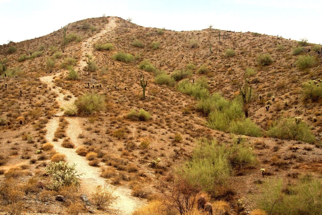
South Phoenix. About 19 minutes from downtown to the main entrance; the Pima Canyon trailhead is 17 minutes from Tempe. One of the largest municipal parks in the country, South Mountain covers more than 16,000 acres across three small ranges, the Ma Ha Tauk, Gila and Guadalupe, with more than 100 miles of trails. It’s where to go for distance and for quiet. The National Trail runs the length of the park, and the Holbert, Mormon and Hau’pal Loop trails climb toward the ridge from the north side; those four are the ones the city restricts in extreme heat.
The park’s high point open to the public is Dobbins Lookout, at 2,330 feet, which you can reach by trail or by driving the Summit Road, a good way to see the view without the climb. Watch the calendar: on the fourth Sunday of each month the Summit Road is closed to cars all day for Silent Sundays, and on the other Sundays it’s closed from 5 to 10 a.m. at the 1-mile marker, so park at the Activity Complex. The main entrance and parking are open 5 a.m. to 7 p.m., which means a sunset drive to Dobbins only works when sunset comes before 7, roughly October to March.
Papago Park and Hole-in-the-Rock
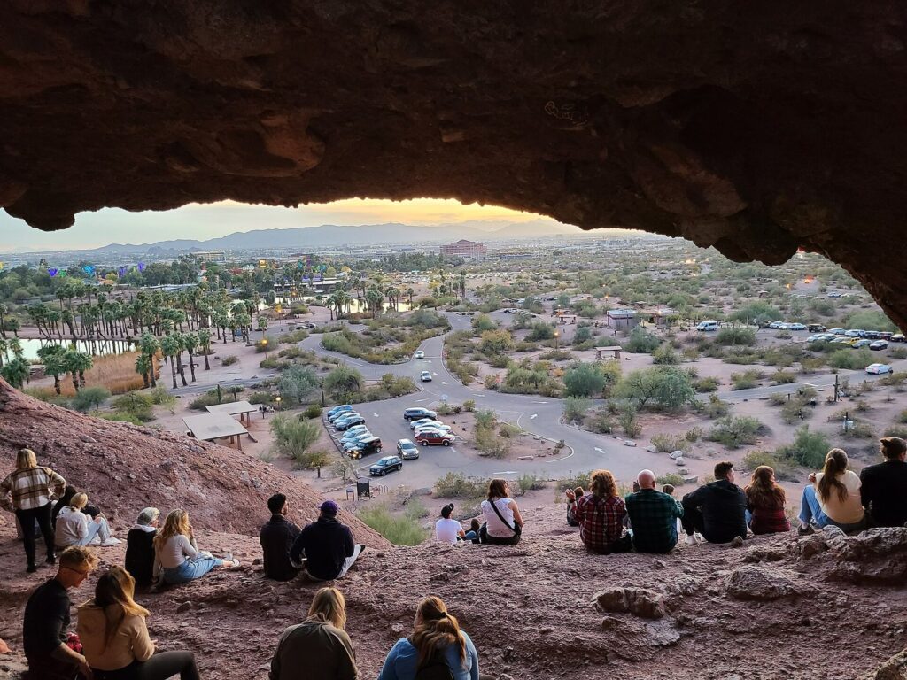
East Phoenix, on the Tempe line. 17 minutes from downtown. Papago Park’s red sandstone buttes are the easiest mountain scenery in the Valley. The Hole-in-the-Rock trail is just 0.2 mile, rated easy, from the Papago Park visitor center at 625 N. Galvin Parkway up to a window in the rock that frames the city, and it’s a favorite at sunset. The lot is open 5 a.m. to 7 p.m. and the trail 5 a.m. to 11 p.m., so a true sunset visit works from roughly mid-September to mid-April, when the sun sets before 7 (checked September 2026). The park’s other short trails loop around the buttes and past the Desert Botanical Garden and Phoenix Zoo, which makes it an easy half day with kids.
The Phoenix Sonoran Preserve and Deem Hills
North Phoenix. About 45 minutes from downtown. On the city’s northern edge, the Sonoran Preserve covers more than 9,600 acres with three trailheads and 36 miles of trails through open saguaro desert, with rolling hills rather than summits. Nearby, the Deem Hills Recreation Area’s almost 1,000 acres are known for dark basalt rock formations. Both are good choices if you’re staying in the north Valley and want quiet desert trails without the crowds of the central peaks.
McDowell Sonoran Preserve
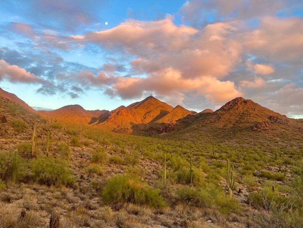
North Scottsdale. 40 minutes from downtown Phoenix, 24-25 from Old Town Scottsdale to the Gateway trailhead. Scottsdale’s preserve is the biggest trail network in the Valley: more than 30,500 acres with over 230 miles of multi-use trails, free, and open from sunrise to sunset. The Gateway trailhead, at 18333 N. Thompson Peak Parkway, has restrooms and water and a choice of loops, from easy desert walks to the climb toward Thompson Peak. Tom’s Thumb, a granite pinnacle reached from its own trailhead at 23015 N. 128th Street, 40 minutes from Old Town, is a steep, rewarding climb with long views. Brown’s Ranch, in the preserve’s north, was closed for improvements when checked in September 2026.
Scottsdale doesn’t restrict its preserve trails for heat the way Phoenix does, but the city recommends hiking before 10 a.m. or after 5 p.m. in summer, and its trails are just as exposed. Electric bikes are prohibited.
Pinnacle Peak
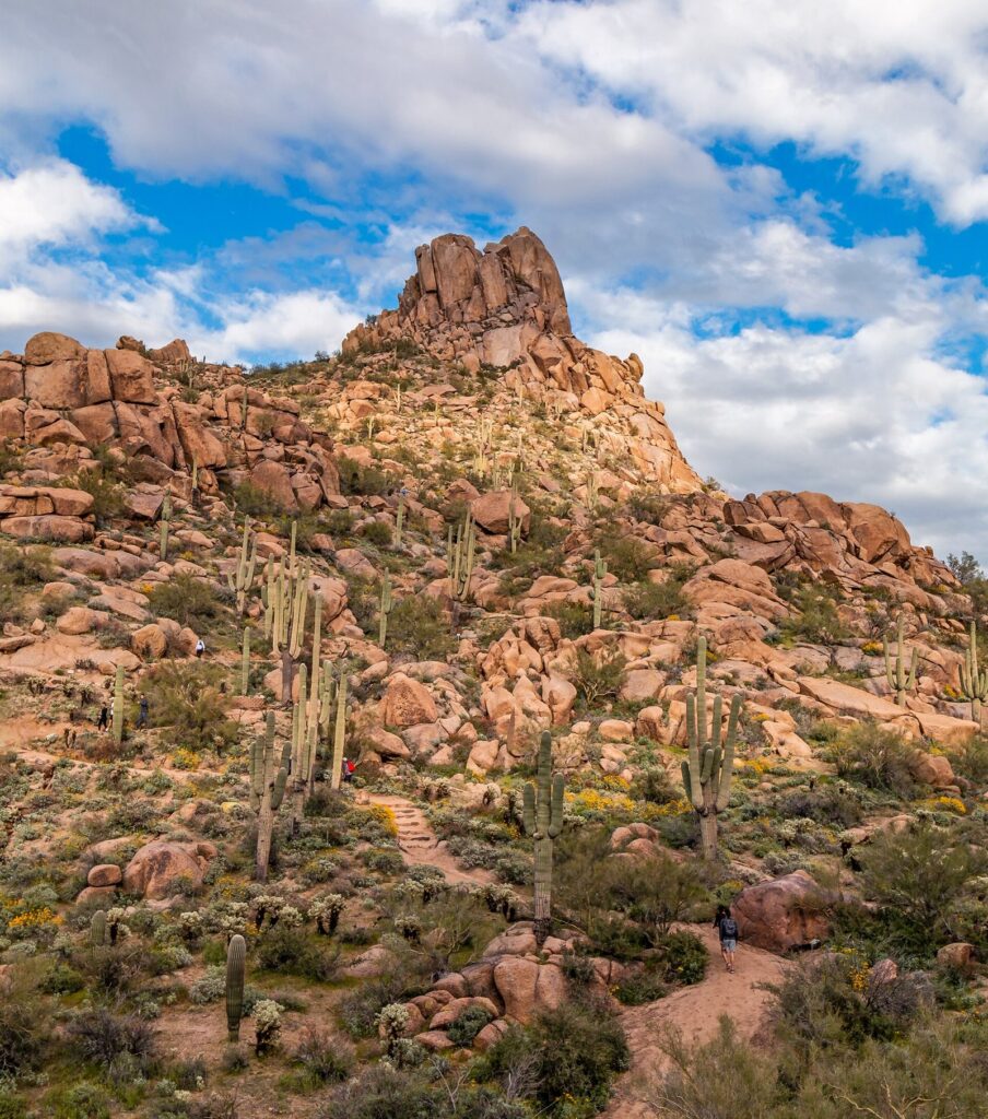
North Scottsdale. 47-48 minutes from downtown Phoenix, 34-35 from Old Town. Pinnacle Peak Park’s single trail runs 2 miles one way, out and back rather than a loop, through granite boulders and saguaros below the peak, with 1,300 feet of total climbing as it rolls up and down, a high point of 2,889 feet and big views to the north and east. It’s well graded and well marked, which makes it the best “real hike” in the Valley for people who don’t want a scramble. You don’t have to go to the end; the views start early.
Dogs and bikes aren’t allowed. The park’s hours change through the year on a posted schedule, and rangers begin closing the trail an hour before the posted closing time; if you aren’t near the end of the trail by then, you’ll be asked to turn around (checked September 2026). Verdict: the best choice for a Scottsdale base, and the easiest big-view trail in the Valley.
Lost Dutchman State Park and the Superstitions
Apache Junction, east of Mesa. 56 minutes from downtown. Lost Dutchman State Park sits at the foot of the Superstition Mountains, “only 40 miles east of Phoenix” in the park’s words, with trails from easy desert loops to the steep Siphon Draw climb toward the Flatiron. Day use costs $10 per vehicle with one person, $20 with two to four and $5 for walk-ins and cyclists (checked September 2026). It’s the Valley’s most dramatic desert scenery within an hour, and it’s best from November to April. In summer the trails are exposed and barely higher than the city, so treat them like any other desert trail: dawn only.
Usery Mountain and White Tank Mountain regional parks
Usery: east of Mesa, 46 minutes from downtown and 36 from Tempe. White Tank: far West Valley, 61 minutes from downtown. Maricopa County runs the two biggest desert parks on the Valley’s edges, and both charge a $10 vehicle entry fee in 2026, or $5 per person for walk-ins and cyclists. Usery’s Wind Cave Trail climbs to a shallow alcove in the Goldfield Mountains with a view back over the East Valley. White Tank’s Waterfall Trail leads to petroglyphs and a seasonal pour-off that runs only after rain. Both are pleasant cool-season choices if you’re staying on that side of the Valley, and neither is worth a long drive from Scottsdale. The county’s annual fire ban runs May 1 to September 30.
How do you plan a summer dawn hike, step by step?
If you’re in Phoenix between June and September and still want a mountain, this is the procedure that keeps it safe. It takes more planning than a winter hike, and every step matters.
The night before. Check the National Weather Service forecast for an Extreme Heat Warning. If one is in effect, the summit trails at Camelback, Piestewa Peak and South Mountain will be restricted from 8 a.m., so either plan to be off them well before or choose a lower trail elsewhere. Pick a short route you can finish in under two hours, lay out your gear and fill your bottles, with about a liter per hour of hiking and something salty. Drink water in the evening and again when you wake up.
At the trailhead. Arrive before first light. In mid-June the sun rises at 5:18 a.m., so that means around 5 a.m.; Piestewa’s trails open at 5 a.m. and Camelback’s at sunrise. Check the temperature on your phone: summer mornings often start in the 80s and climb fast. Tell someone your route and your turnaround time, and set an alarm for it.
On the trail. Go slower than you would in winter, drink on a schedule rather than when you’re thirsty, and take shade breaks. Turn around at your alarm or when half your water is gone, whichever comes first, even if the summit is in sight. Heat builds on the way down, when the sun is higher and you’re tired.
Afterwards. Be back at the car by about 8 a.m., before the restriction on warning days and before the real heat on any day. Cool off in air conditioning, keep drinking and eat something salty. If anyone felt dizzy or sick on the trail, treat that as a warning for the rest of the day and stay indoors.
When is the best time of day and year to hike in Phoenix?
From November through March you can hike almost any time the trails are open, and the constraint is parking, not heat. Go early on weekends anyway. From April and October the midday sun is already strong, so start at sunrise and finish by late morning. From May through September, the only good hiking window is the first hour or two after sunrise, which comes at 5:28 a.m. in mid-May, 5:18 a.m. in mid-June and 5:29 a.m. in mid-July.
| Month | Normal high (1991-2020) | Mid-month sunrise | When to hike |
|---|---|---|---|
| November-February | 66.2°F-76.5°F | 6:59-7:32 a.m. | Any time the trail is open; parking is the limit |
| March | 78.1°F | 6:40 a.m. | Mornings and late afternoons; the busiest month |
| April | 85.5°F | 5:59 a.m. | Start by 7 a.m.; finish by late morning |
| May | 94.5°F | 5:28 a.m. | Start at first light; off exposed trails by 9 |
| June-August | 104.2°F-106.5°F | 5:18-5:50 a.m. | First light only; short routes; expect restrictions |
| September | 100.4°F | 6:11 a.m. | First light only |
| October | 89.2°F | 6:32 a.m. | Early mornings, easing through the month |
Evenings look tempting in summer, but they aren’t cool. The rock gives back the day’s heat long after sunset, and evening temperatures above 100°F are common in July, when the normal low is 84.5°F. If you hike at night, stay on trails you know, carry a light and plenty of water, and watch the park’s closing time.
What should you do instead of hiking in July?
Hike at dawn, go short, then switch activities. A 20-minute sunrise walk to Hole-in-the-Rock or a drive up South Mountain’s Summit Road at 5 a.m. gives you the desert without the risk. After that, move to water or altitude. Salt River Tubing’s 2026 season ran from late April to the end of September, and the Valley’s lakes are covered in our guide to lakes near Phoenix. For real hiking in July, go up: Flagstaff’s normal July high is 82.0°F and Prescott’s 90.3°F, against 106.5°F in Phoenix, and both have pine-forest trails a couple of hours north.
The honest summer verdict: don’t plan a Phoenix trip around a summit hike between June and September. If a hike is the point of your trip, come between November and March.
How do you park at Phoenix trailheads?
Arrive early, have a plan B and don’t block neighborhoods. Echo Canyon is the tightest: one lot with a gate that closes when it’s full and police who ticket cars idling nearby. Cholla has only marked street parking. Piestewa spreads its parking along the park road, which absorbs more cars, and its lots stay open until 9 p.m. from June through September for early-evening hikers. South Mountain’s lots are big, but Silent Sundays change where you can drive. McDowell Sonoran’s Gateway trailhead has a large lot with restrooms and water, and Pinnacle Peak’s lot is busy on winter weekends.
The fees are simple (2026 rates). City of Phoenix and Scottsdale trailheads are free. Maricopa County regional parks charge $10 a vehicle, Lost Dutchman State Park $10 to $20 depending on how many people are in the car, and Spur Cross Ranch, north of Cave Creek, charges a per-person entry fee.
What are the best Phoenix hikes with kids?
Keep it short, shaded where possible and early. Hole-in-the-Rock is the classic first hike for children: 0.2 mile to a sandstone window they can climb into, 17 minutes from downtown, with the Desert Botanical Garden and Phoenix Zoo next door for the rest of the morning. The lower loops at Piestewa Peak and South Mountain give older kids a real desert trail without the summit’s steepness, and the easy loops from the McDowell Sonoran Preserve’s Gateway trailhead have the bonus of restrooms and water at the start.
Skip the big summits with young children. The city rates the Piestewa, Echo Canyon and Cholla trails extremely difficult, the descents are loose, and rescues on them are routine. Carry water for every child as if they were an adult, start at sunrise from April onward, and turn around the first time someone flags, not the third. A good family hike in Phoenix ends with everyone wanting more, not with someone being carried.
What should you do if a storm rolls in?
Get down and get out of the washes. From July into September, monsoon thunderstorms build over the mountains in the afternoon, and an exposed summit is the worst place to be when lightning starts; if you hear thunder, head down immediately. Rain that falls on the mountains can send water roaring down dry washes and across trails within minutes, even if it isn’t raining where you are, so never wait out a storm in a wash or cross running water. Winter storms are gentler but make granite and sandstone slick, and a wet descent on Camelback is no place to hurry. After heavy rain, give the trails a day to drain; the rock dries fast, but loose gravel and mud on steep sections stay treacherous.
What trail rules and etiquette should visitors know?
Phoenix’s preserves are busy, and a few habits keep them pleasant and legal. Stay on designated trails; the city’s code requires it, and cutting switchbacks on steep, loose slopes is how people fall and how trails erode. On narrow sections, hikers heading uphill usually get the right of way, and runners and faster hikers will call out before they pass. Carry out everything you carry in, including dog waste, which the city also requires you to pick up. Smoking and open flames are a bad idea anywhere in dry desert, and Maricopa County’s parks run an annual fire ban from May 1 to September 30. Finally, respect closures: a restricted trail on an Extreme Heat Warning day, a closed trailhead like Brown’s Ranch or a gate that has shut because the lot is full all mean the same thing.
Can you hike in Phoenix without a car?
For the central trails, yes, with a little planning. Rideshare services and Waymo’s driverless cars cover much of central Phoenix and Scottsdale, which puts Papago Park, Piestewa Peak and Camelback’s trailheads within reach of a phone. Book the ride back before your battery runs low, and remember that pickup spots at busy trailheads can be crowded after sunrise. The outer preserves, the county parks and Lost Dutchman are a different story: they’re 40 minutes to an hour away, and you’ll want a car.
Are there guided hikes or ranger programs?
The City of Phoenix runs Hike Right PHX, a program for people who want to explore city trails but aren’t sure where to start, and its parks and preserves host ranger-led walks through the cool season. In north Scottsdale, Taliesin West adds hikes with an architectural twist: in 2026-27 its Golden Hour Sunset Hike runs on weekend evenings from October 3 to December 27, 2026, its Apprentice Shelter Hike on weekend mornings from January 2 to March 28, 2027, both at $65, and a Sonoran Desert Plant Hike and Tasting costs $85 (checked September 2026). Commercial guided desert tours and jeep tours are a separate category and a good choice if you’d rather not navigate at all.
What to skip
- Skip Camelback at 10 a.m. on a winter weekend. The Echo Canyon lot is usually full all day on weekends, and circling the neighborhood gets you a ticket, not a space. Go at sunrise or go to Piestewa.
- Skip any summit trail after 8 a.m. from June to September. On Extreme Heat Warning days they’re closed anyway; on the others, the heat is the same.
- Skip bringing the dog on Camelback or Piestewa’s Summit Trail. Dogs are banned there year-round, and on all city trails above 100°F.
- Skip judging a trail by its mileage. Piestewa’s 1.2 miles and Echo Canyon’s 1.14 miles are rated extremely difficult for a reason: 1,200 to 1,400 feet of climbing.
- Skip hiking alone without telling anyone. More than 200 hikers are rescued from Phoenix’s preserves each year.
- Skip Brown’s Ranch trailhead for now. It was closed for improvements in September 2026; use Gateway or Tom’s Thumb.
- Skip the far county parks if you’re staying in Scottsdale. White Tank is 75 minutes from Old Town; the McDowell Sonoran Preserve is 24.
Frequently Asked Questions
What is the best hike in Phoenix?
For most visitors, the Piestewa Peak Summit Trail: 1.2 miles one way with 1,200 feet of climbing, 17 minutes from downtown, with a big view and easier parking than Camelback. Fit hikers who want the famous one should do Camelback’s Echo Canyon Trail at sunrise. For big views without a scramble, walk Pinnacle Peak’s 2-mile trail in north Scottsdale.
When is it too hot to hike in Phoenix?
From June to September, any time after mid-morning. Phoenix averages 111 days a year at 100°F or more, and on days the National Weather Service issues an Extreme Heat Warning, the city restricts its summit trails from 8 a.m. to 5 p.m. Hike at first light, carry about a liter of water per hour and be off exposed trails by 8 or 9 a.m.
Are Phoenix trails closed in the summer?
Some are, on the hottest days. When the National Weather Service issues an Extreme Heat Warning, Camelback’s Echo Canyon and Cholla trails, the Piestewa Peak Summit Trail and four South Mountain trails are off-limits from 8 a.m. to 5 p.m. In 2024 that happened on 45 days between May 1 and October 13. Other trails stay open but are just as hot.
How much water should you bring hiking in Phoenix?
About one quart, or roughly a liter, for each hour of hiking in hot weather, the figure the National Park Service uses for desert heat, plus salty snacks or an electrolyte drink. The City of Phoenix says to drink before you start and carry more than you think you need. Turn back when half your water is gone.
Is Camelback or Piestewa Peak harder?
Camelback. Its Echo Canyon Trail climbs 1,400 feet in 1.14 miles over steep rock with a handrail section, and the Cholla Trail 1,420 feet in 1.5 miles with a scramble near the top. Piestewa’s Summit Trail climbs 1,200 feet in 1.2 miles on a more built path. The city rates all three extremely difficult, so neither is a casual walk.
Can you bring dogs on Phoenix hiking trails?
On some. Dogs are banned year-round on all Camelback trails and the Piestewa Peak Summit Trail, and on every City of Phoenix trail when it’s above 100°F. Elsewhere, Phoenix requires a leash of 6 feet or less. Scottsdale’s McDowell Sonoran Preserve also requires a 6-foot handheld leash, and Pinnacle Peak Park doesn’t allow dogs at all.
What are some easy hikes in Phoenix?
Hole-in-the-Rock in Papago Park is a 0.2-mile walk to a sandstone window, 17 minutes from downtown. The lower trails at Piestewa Peak and South Mountain wind through the desert without the summit climbs. In Scottsdale, the loops from the McDowell Sonoran Preserve’s Gateway trailhead start easy, and Pinnacle Peak’s trail is well graded if you turn around early.
Do you have to pay to hike in Phoenix?
Not on city trails. Camelback, Piestewa Peak, South Mountain, Papago Park and Scottsdale’s McDowell Sonoran Preserve and Pinnacle Peak are free. Maricopa County regional parks such as Usery Mountain and White Tank Mountain charge $10 per vehicle, and Lost Dutchman State Park charges $10 to $20 per vehicle (checked September 2026).
Related Phoenix Guides
- Phoenix-Area Lakes and Rivers: the Salt River, Saguaro Lake and Lake Pleasant, for the months when hiking gives way to water.
Sources and verification
This guide is built from research, not hosted hikes. Trail rules, hours, fees and parking details were checked on September 24, 2026, against the agencies below. Drive times are off-peak estimates from OSRM routing on OpenStreetMap data, and sunrise times are computed for downtown Phoenix.
- City of Phoenix: hiking and trails; trail heat safety program; Take a Hike. Do it Right.; Camelback Mountain
- City of Scottsdale: Pinnacle Peak Park; McDowell Sonoran Preserve
- Maricopa County Parks: regional park fees
- Arizona State Parks: Lost Dutchman State Park
- National Park Service: Hike Smart hot-weather guidance
- NOAA and the National Weather Service: Phoenix extreme temperature records; 1991-2020 normals for Phoenix, Prescott and Flagstaff
Photo Credits
- Piestewa Peak parking: photo by Wheatley2, Wikimedia Commons (CC BY-SA 4.0)
- South Mountain Park trail: photo by ksblack99, Wikimedia Commons (public domain)
- Hole-in-the-Rock, Papago Park: photo by Bigmacthealmanac, Wikimedia Commons (CC0)
- McDowell Mountains at sunset: photo by Wiwad, Wikimedia Commons (CC BY 4.0)
- Pinnacle Peak in spring: photo by Ray Redstone, Wikimedia Commons (CC BY-SA 4.0)
- Echo Canyon Trail, Camelback Mountain (featured image): photo by Hoplophile, Wikimedia Commons (CC BY-SA 4.0)